
Well, I’ve done it again. I spent a perfectly good Sunday hiking around mountains in the Pacific Northwest. This time, I was last week in Washington, hiking the Bluff Mountain Trail.
When researching hikes around the area, I specifically looked for hikes with great views of the Cascades. As much as I love just being outside, communing with nature, I really enjoy spectacular views. I love mountains, especially big ones. And if I’m not quite ready yet to try to climb the big mountains, at least I can get good looks at them from more manageable places.
Silver Star Mountain came up in my research. Less than two hours from Portland, it’s supposed to provide views of some of the same peaks that can be seen from Mt. Defiance, but with less pain and suffering. It’s over 4,000 ft, and not incredibly difficult to ascend. However, Silver Star apparently gets pretty busy, especially on weekends.
So, I found a longer trail that starts from a bit west of the main routes up Silver Star. The Bluff Mountain Trail starts from a fairly high elevation (about 3,500 ft), and winds its way past two other mountains. After around six miles, the trail connects with the Starway Trail, and fairly quickly deposits one on the summit of Silver Star. My research promised me the Bluff Mountain route would involve great views along exposed ridges, and greatly reduced foot traffic compared to the other Silver Star hikes.
This past Sunday morning, I headed north from Portland, driving through Vancouver, Washington. Depending on the route, the drive from downtown Portland to the trailhead is in the 50 to 56 mile range. However, it takes nearly 2 hours, even with light traffic. The first 40 minutes got me to within a dozen miles – but the final hour was spent traversing winding gravel roads. The roads aren’t designed with passenger cars in mind, and there are all sorts of massive holes and divots and even some boulders in the road. There were plenty of points where I would have to creep over bumps at angles to avoid tearing up my relatively low-clearance car. But I did make it. It just required some patience. Also, there’s a bunch of deer out there, and they have no trouble stepping out in front of cars without warning.
Anyhoo, I finally parked at the trailhead. It was a wide, flat dirt area with sharp drops (and excellent views) to the east and west, and the start of the trail heading south. The trail itself is wide enough for a car – at least for the first 3/4 of a mile or so. But I was done driving at the trailhead.
Finally, at 7:50 in the morning, with temperatures around 50 degrees, I set out down the trail.
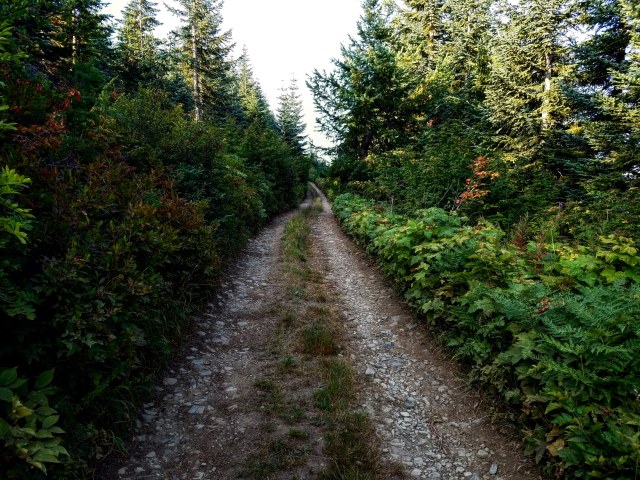
It starts out meandering up and down, but fairly straight south. The elevation changes seemed pretty minimal. There were some trees on either side, but frequently the road was raised above them and provided lovely views of the valleys and hills below.
Hunter Breckenridge – 2018
Hunter Breckenridge – 2018
There were a couple trails that split off from the main one in this section, including one that led to a cabin off to the left. I could hear a dog barking up there. Considering the number of spent shotgun shells I found littering the trail, I assumed some hunting went on around here. I resolved to avoid looking like a deer as I made my way down the path.
Hunter Breckenridge – 2018
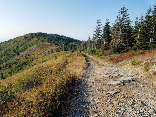
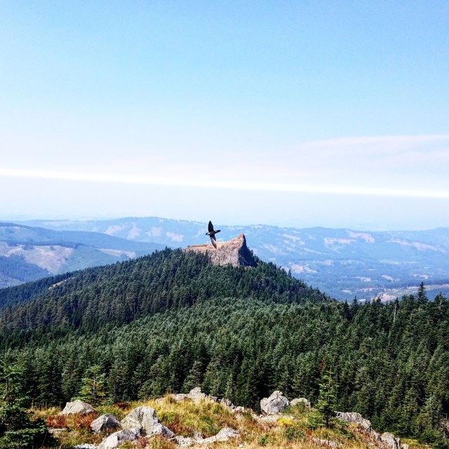
I finally reached a flat open area, sort of like a mini-version of the lot at the trailhead. This area provided gorgeous views all around me, including of Bluff Mountain, Little Baldy Mountain, and my eventual goal, Silver Star Mountain, though at the time time, I wasn’t realizing that was Silver Star off in the distance.
Hunter Breckenridge – 2018

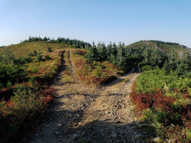
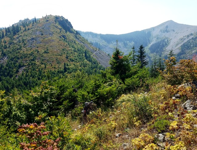
Hunter Breckenridge – 2018 – The twin peaks connected by the saddle in the middle of the image, in the distance, is Silver Star Mountain.

Hunter Breckenridge – 2018 – Mount Saint Helens through the haze.
Looking north, I could still make out Mount Saint Helens looming over me. However, the haze that’s been perpetually choking the area for the last few weeks (thanks to fires from California to Washington) was already noticeably thickening, and the views of the more distant Cascade peaks were fading from view. I had some hope it might clear up by midday, but – spoiler alert – ’twas not to be.

Hunter Breckenridge – 2018
After a few minutes of taking in the views, I decided to press on. I noted, however, in this open area (which seemed to be the ending point of the driveway part of the trail), there was no obvious path onward. For some reason, I didn’t think to check the map I had queued on my phone. I just knew that I was supposed to push forward another quarter of a mile or so before the path started through the woods and on toward Bluff Mountain. I finally found an incredibly narrow dirt trail at the south end of the open area. It barely looked passable. I thought about doubling back for a short distance, to see if there was another trail opening I missed earlier. But that would have been sensible, which isn’t always in my vocabulary.
So I decided to try the narrow dirt path.
Whoops.
It didn’t take long for me to have to start shoving my way through dense growth, the “trail” barely visible beneath my feet. I could tell I was starting to move downhill, and was getting nervous about the path dropping out underneath me. I still don’t know why I didn’t turn back, though I was feeling a bit discouraged.
Finally, after around 300 feet or so of bushwacking, the path cleared up, and I could see an actual dirt/rock trail heading perpendicular to my path. I dropped down on it, and stopped for a breather. I pulled out my phone and actually looked at the map. And yeah, sure enough, the trail I needed started about 100 feet behind where I pushed ahead. I just didn’t pay attention as I hiked past it.
Fortunately, I didn’t injure myself. And I was back on a recognizable path. I looked south, and could see the bulk of Bluff Mountain, with Little Baldy Mountain sitting just to the right. The trail itself went left, away from the mountain, but this time I decided to trust my map. I knew this would take me where I needed to go.
Hunter Breckenridge – 2018
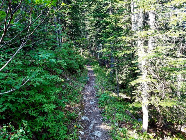
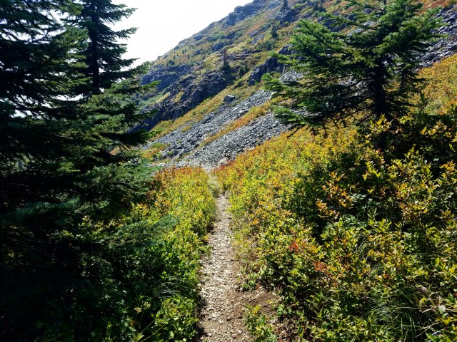
The trail down the slope and into the woods, eventually heading toward Bluff Mountain, was full of wispy trees, wildflowers, and thorny bushes.
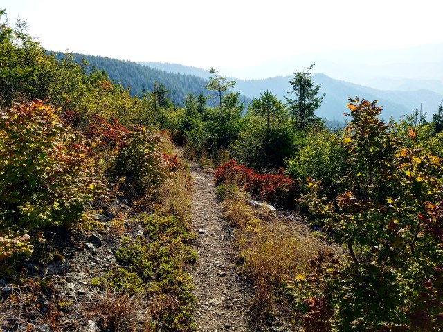
Hunter Breckenridge – 2018

Hunter Breckenridge – 2018
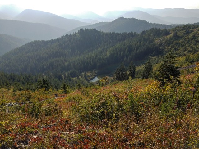
And just to the east were some gorgeous views of the valley that would eventually lead to Mount Adams. Sadly, that mountain was obscured by haze. But closer to my location, the rolling hills and valleys were displayed in their full splendor.
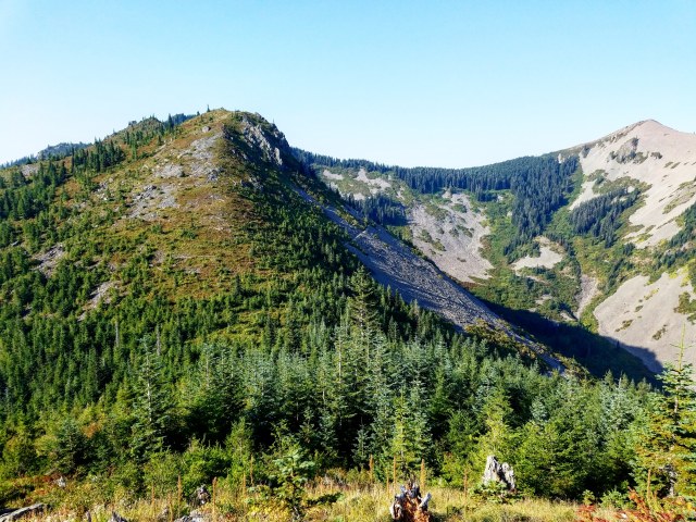
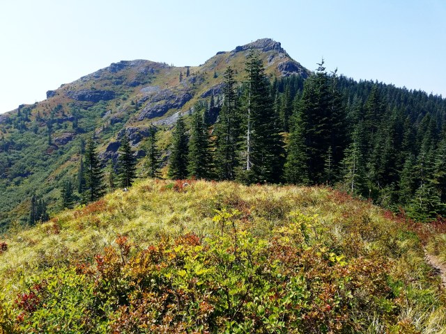
After some time winding down the trail, and through the woods, I finally stepped up to Bluff Mountain. The trail veered to the right, running along the western flank of the mountain.
Hunter Breckenridge – 2018
To the west, across a valley, was the next mountain on my hike, Little Baldy Mountain. It’s talus-covered slopes certainly contributed to the “bald” moniker. But there was a history behind the name.
Hunter Breckenridge – 2018
The Yacolt Burn in 1902 swept through this region, destroying huge swaths of vegetation (not to mention killing 60-some people). More than a hundred years later, many of the higher peaks remained empty of large trees, thanks to that disaster.
The trail on Bluff Mountain continued running along the side of the cliff, maybe halfway up between the floor of the valley below, and the exposed craggy peak above. Supposedly, the summit of Bluff Mountain could be reached via a quick scramble, but since I was new to the trail and the area, I decided to stick with the clear path for the time being. Perhaps a return trip with another person would prompt me to make that side trip.
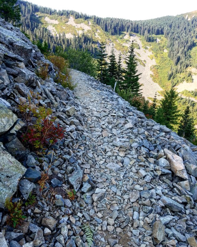
At one point, the trail more or less disappeared as a recognizable path, and just became a pile of rocks – essentially an extension of the talus field that lead to the bottom.

Hunter Breckenridge – 2018
It was a bit treacherous, but eventually eased up, and turned back into the dirt/rock path that had gotten me this far.

Hunter Breckenridge – 2018
At some point, I looked back the way I came, and was treated to a great view of Mount St. Helens, gradually becoming more obscured by the haze.

Hunter Breckenridge – 2018
The trail would eventually reach the point where the south end of Bluff Mountain ran into the south end of Little Baldy Mountain, creating the closed end of the valley between them.

Hunter Breckenridge – 2018
The trail would veer right, off Bluff Mountain, and into the woods at the end of the valley. There were some lovely views of the north from that end – peaking through gaps in the trees.
At this point, it was a bit past 9:30 – nearly two hours after I started. In those two hours, the bulk of Saint Helens had finally been cloaked by the dense residue of the fires that continue to engulf so much of the Pacific coast states.
Meanwhile, as I made my way west through the woods, I looked down the the slope into the valley, and heard what sounded like helicopters first starting their rotors. Massive birds that I guessed may have been vultures took off, likely disturbed by my presence. They sounded enormous, although I only was able to catch glimpses of them.
The trail started moving uphill again, and I plunged into a wider wooded area. This was behind the south end of Little Baldy, and could have been a forest pretty much anywhere.

Hunter Breckenridge – 2018
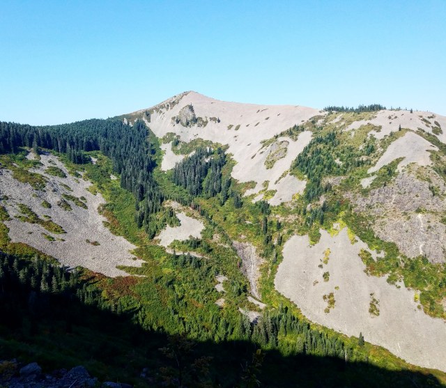
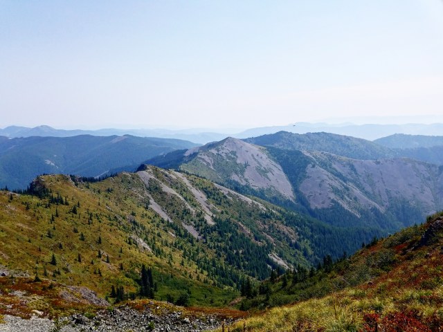
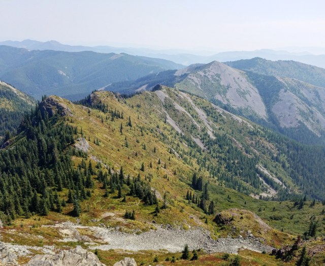
After maybe 10 minutes in this forest, I came out into a clearing, and begun looping around Little Baldy, along its western flank. This provided amazing views to the south, toward Oregon, as well as my eventual target, Silver Star, off to the west.
Hunter Breckenridge – 2018

Hunter Breckenridge – 2018 – Looking at Silver Star Mountain from the talus covered western side of Little Baldy Mountain.

Hunter Breckenridge – 2018
Briefly glancing up and to my right, I could see the talus wall looming above me. This was also something intrepid hikers and climbers would sometimes scramble. There were apparently some interesting pits dug into the field at the summit. Maybe next time, with an early start and a friend or two, I might make a run at it.

Hunter Breckenridge – 2018
The trail on the talus field stretched all the way to the north end of Little Baldy, where it finally turned left, into an area of dense vegetation. At this point, it was nearly 10:30.

Hunter Breckenridge – 2018
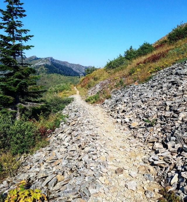
The trail headed west, gradually becoming more exposed.
Hunter Breckenridge – 2018 – Looking back at Little Baldy.
Hunter Breckenridge – 2018

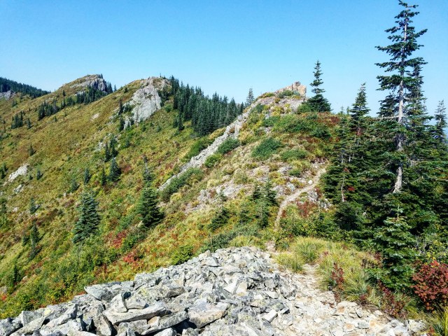
Hunter Breckenridge – 2018 – Getting closer to Silver Star
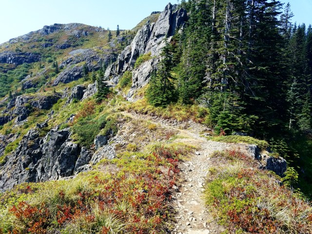
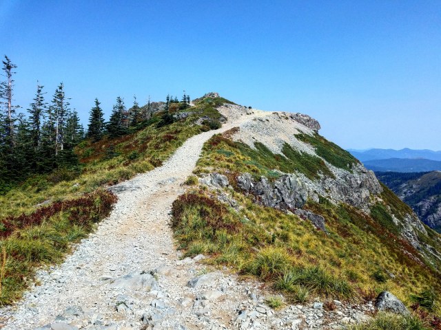
The ridge that ran between the northwest corner of Little Baldy and the northeast corner of Silver Star stretched mostly straight west for about a mile and a half. At around the halfway mark were a few switchbacks, as the trail gained elevation, wrapped around the north end of the ridge, and came up to a wide exposed area, with 360 degrees of views. The drops on either side were substantial, with the north end a little steeper, but both likely near 1,000 feet. Even with the haze preventing views of the more distant peaks, it was spectacular. It was around 11:00 at this point, when I met someone coming the other way. A hiker pushing his mountain bike laden with packs very gingerly along the rocky trail. We chatted briefly, he told me how much this part sucked for someone with a bike, and I let him know it probably wasn’t going to be getting any better for awhile. I wished him luck, and we went our separate ways.

Hunter Breckenridge – 2018
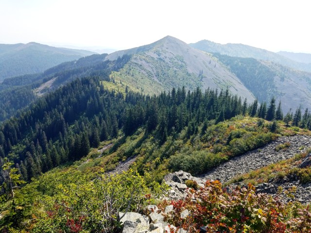
I continued pushing down the ridge, enjoying the views and solitude. At one point, as I neared Silver Star, I could make out tiny dots making their way across the saddle between the two peaks. I accelerated my pace a bit, hoping I could summit before noon.
Hunter Breckenridge – 2018

Hunter Breckenridge – 2018 – Looking back the way I came.
By 11:30, I was directly underneath the summit (maybe 700 feet or so below), and the trail dove back into the woods, heading around the north side of the mountain.
Hunter Breckenridge – 2018
There was a steep, narrow trail leading off to the left that I assumed was a shortcut. I could hear voices up that trail. I decided to continue with the planned route, but perhaps next time, I might explore a little more.
At 11:45, I reached the trail junction. The Bluff Mountain Trail finally intersected here with the Starway Trail, the shorter route that heads north toward the Silver Star Trailhead,
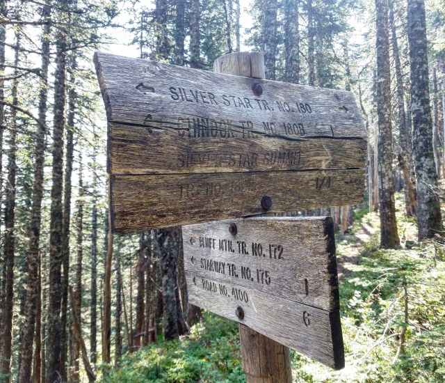
Hunter Breckenridge – 2018
The next stretch was much steeper than what I had been dealing with. I was still feeling pretty good at this point, but I imagined this last bit up to the summit could be draining.
There was one straightaway, gradually drifting southeast, with an interesting cairn in the middle of a trail junction.

Hunter Breckenridge – 2018
The final approach was pretty quick. It only took about 10 minutes to reach the summit saddle from the Bluff Mountain-Starway junction. I stepped up into a big open area. Directly east was the valley I had just hiked past, with Little Baldy off in the distance. To my right was the lower summit, and to my left was the true summit,
Hunter Breckenridge – 2018
Hunter Breckenridge – 2018 – Silver Star summit, from the saddle.
I trudged up the remaining slope. At 11:58, four hours and eight minutes after I started, I reached the top of Silver Star Mountain. There were a couple hikers sitting on a ledge, looking east, enjoying lunch. I walked past them, and up to the shattered base of what was an old fire lookout station. While the haze was only getting worse, I could still see quite a way. The ghostly outline of Mount Hood was barely visible through the smog to the south.

Hunter Breckenridge – 2018 – The ghost of Mount Hood can barely be seen here.
To the west, birds-of-prey swooped above the trees, enjoying the air currents flowing through the valleys.
Hunter Breckenridge – 2018
Off to the east, I could see the way I came. If I looked carefully, I could make out much of the trail, including along the talus slope of Little Baldy.
Hunter Breckenridge – 2018
I took a few minutes for myself, took off my pack, and enjoyed a breather.

By 12:15, I decided to head back down. More hikers were coming up the saddle, and I was hoping to be back in Portland by 6 PM. Better get moving.
I headed back down the saddle, made a right down the final slope, and down to the Bluff Mountain junction.
From then on, it was just a steady hike along the ridge between Silver Star and Little Baldy.
Hunter Breckenridge – 2018

Hunter Breckenridge – 2018

Hunter Breckenridge – 2018
Occasionally, I would glance back at the receding form of Silver Star.
Hunter Breckenridge – 2018

Hunter Breckenridge – 2018
About an hour after departing the summit, I was back on Little Baldy.

Hunter Breckenridge – 2018
Then behind Little Baldy, vaulting over logs in the woods.

Hunter Breckenridge – 2018
I was walking across the west side of Bluff Mountain…

Hunter Breckenridge – 2018
And then by 2:30, I was stepping off Bluff Mountain, heading back up the trail, toward the long driveway back to the trailhead.
Hunter Breckenridge – 2018
This time, I stayed on the trail, and realized that I indeed did miss the trail turnoff earlier that morning.

Hunter Breckenridge – 2018 – Silver Star now in the distance.
The final leg north toward the car felt like it took forever, although much of that was due to the fact that it was finally getting noticeably hot.
At 3:20 pm, I stepped off the trail, and walked up to my car.
This was a fun one. I got plenty of exercise, walked more than 12 miles, got to hang around three mountains, reaching the summit of tallest one. I only encountered one person on the Bluff Mountain trail. Everyone else I met was on Silver Star itself. I recommend to anyone looking for some solitude and some great views (depending on the state of forest fires in the region) to take the long way. I wouldn’t call the Starway trail part crowded, but there definitely were people making their presence known. But east of there, along Little Baldy and Bluff Mountain, I felt truly alone.
And it was glorious.
Just drive carefully on your way to the trailhead, especially if you don’t have a vehicle built for rough terrain.

Pingback: Hiking Report – Battle Ax Mountain | A Skewed Perspective
Great readiing your blog