I used to write about politics. In fact, it wasn’t that long ago that politics were almost the only thing I would write about.
And when I say not that long ago, I mean, just a month ago.
Then I started hiking this summer. And I kept taking pictures, and I wanted to talk about my experiences and observations.
So, here we are. The A Skewed Perspective summer hiking tour.
Or something. I dunno.
I moved to the Pacific Northwest, and this is how I decided to spend my time. I have no regrets.
I’ll be talking about heavier stuff again soon, I promise. Or threaten, depending on your perspective.
But since I do live in the Pacific Northwest now, and I do have time to go find things to hike and climb on during my weekends – I’m going to keep writing about it. And my most recent such adventure happened this past Friday.
For years, certain mountains captured my attention. Most of these are in the Cascades. Maybe it’s the impressive topographical prominence, maybe it’s the picturesque quality of them, maybe it’s the fact that most of them are volcanoes… but for whatever reason, the larger peaks of the Cascades have called to me.
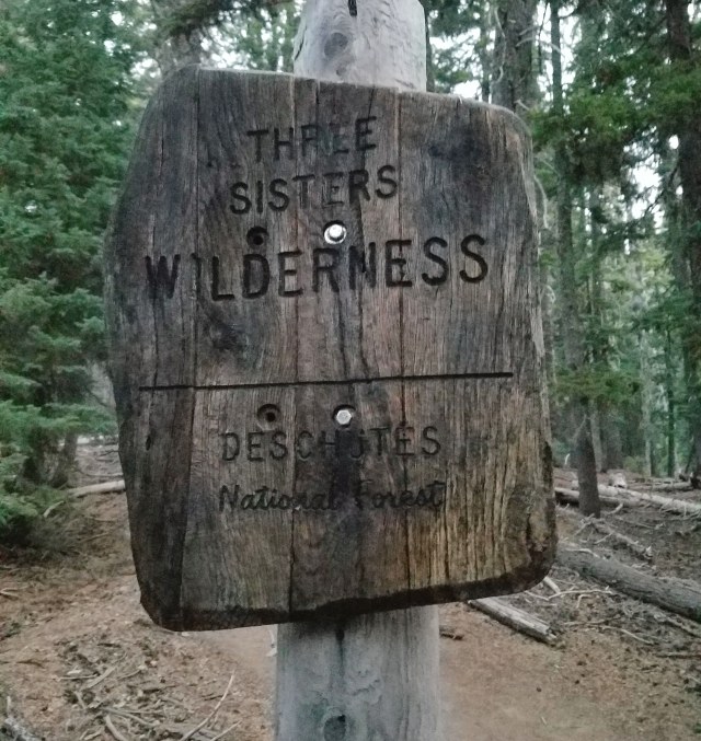
The Three Sisters complex just west of Bend, Oregon has always been among my favorites. Three peaks, all grouped together within a few miles of each other. All three rise to over 10,000 feet in elevation. All three are volcanoes, although the North and Middle Sisters are considered dormant – neither one having erupted in the last 14,000 years. The South Sister, however (the tallest of the three), is thought to have erupted within the last 2,000 years, and showed some tectonic activity as recently as the year 2000. It is considered an active volcano – a point that occasionally came to mind as I hiked it.
The South Sister, while the tallest at 10,363 feet, is considered the easiest of the three to climb. There are well-worn trails that cover most of the distance from Devil’s Lake Trailhead up the south slopes of the mountain to the summit – although the trail does become a bit… muddled at points. Some scrambling over boulder fields becomes necessary at times. It’s a challenge, but doable for someone in decent shape.
South Sister is also known as Charity. The other two are Hope and Faith. It’s often said those are good reminders as to their relative difficulty.
So, all summer, as I’ve hiked a variety of shorter peaks and lower-altitude trails in the Pacific Northwest, I started angling for one big climb near the end of the summer. Something that would provide amazing views, and get me out into the wilderness, while still being a hike that a novice could handle. Mt. Adams came up as an option – but I need some ice and snow climbing equipment that might have to wait for next year. Mt. McLoughlin was another possibility – over 9,000 feet, with a trail to the summit – but it’s also five hours from Portland. I will likely consider that one for next summer as well – but I wasn’t wanting to drive more than three or four hours from home this time around. Mt. Bachelor was another option. It’s also over 9,000 feet and hikable, and also happens to be an hour closer to home than McLoughlin. But just next door to Bachelor was a more challenging option – one that I’ve been thinking about for years.
So, that’s how I decided South Sister would round out my hiking summer. The third-tallest mountain in Oregon would be a challenge. But I believed I could handle it. It would be just me, in the wilderness, for the better part of the day. As I got closer to the day I marked, I became more excited.
So, let me quit babbling about the why, and let’s just get to the how.
Last Thursday, after work, I drove out from Portland, heading southeast in the direction of Bend, Oregon. I didn’t get on the road until around 7 pm, so it was after 10 when I made it to the Devil’s Lake Trailhead, about 20 miles west of Bend.
I considered bringing a tent and camping out at the campground by Devils Lake, but I really didn’t want to deal with the hassle of putting it together and breaking it down just to sleep five or six hours. I wanted to be up early, to ensure I could be done at a reasonable time the next day, so I decided to sleep in my car. Not the most comfortable choice in the world, but I was able to pass out and stay asleep for most of the night.
At 4:30, I was awake. Despite a bright moon, it was still too dark on the trail. I neglected to bring a flashlight or headlamp, so I decided to take my time. I stretched in the parking lot, ate a sandwich, and started organizing my backpack. By 5 AM, there were other people stirring in the parking lot and at the campground. The sun was taking its sweet time illuminating the sky, and so I dawdled around the trailhead until nearly 6, when I decided I couldn’t wait any longer.
I’ve spent more than 800 words setting this up, and since I tend to be too long-winded anyway, I’m going to keep the text part of this narrative to a minimum. Or at least, I’ll try to do so.
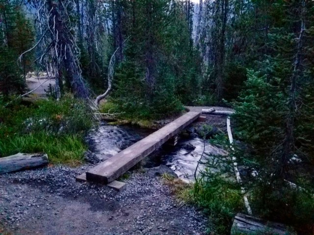
Anyway, I set out past the parking lot, along a trail that wound next to Devils Lake and headed about a quarter mile north to the highway. It was no longer dark, but the light was pretty dim.
Hunter Breckenridge – 2018
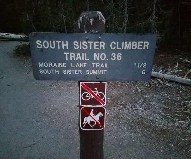
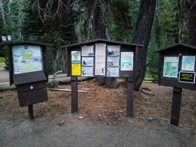
The trail crossed the highway, and by 6:10, I was standing in line behind a half-dozen other hikers, waiting to sign in and get my day pass.
Hunter Breckenridge – 2018
Hunter Breckenridge – 2018
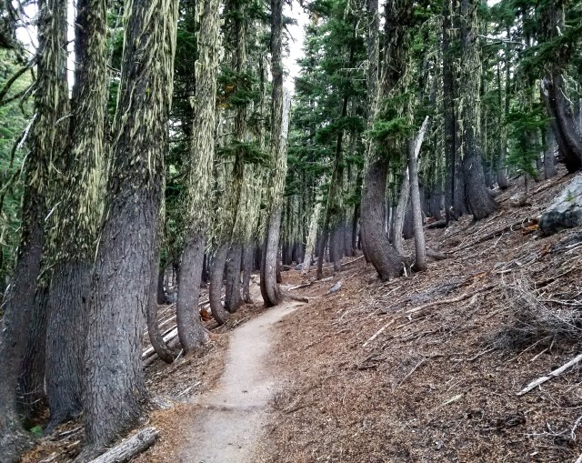
The trail set off north, into the woods. It was fairly steep at points, and I ended up pulling out one of my trekking poles within a few minutes of starting. The temperature was cool – under 50 Fahrenheit, and I had a light jacket and a hoodie on. But I could tell I’d have to shed a layer fairly soon. I tried to maintain a steady pace, but was warming up fast.
Hunter Breckenridge – 2018
Hunter Breckenridge – 2018
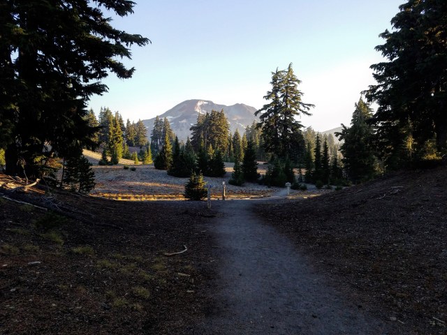
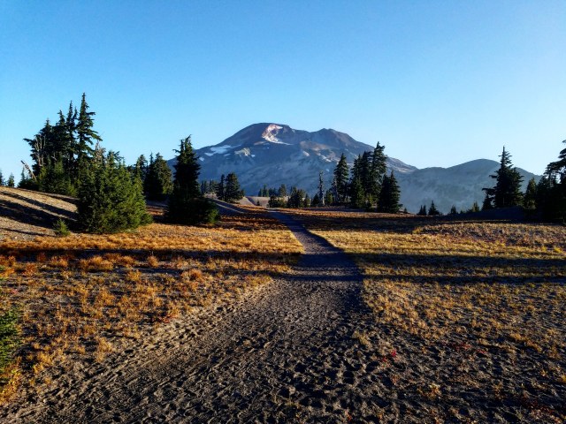
I was in the woods for about an hour. After one particularly steep section of switchbacks, the trail opened up and straightened out. The sun was starting to appear over the horizon, and I found myself on a wide, fairly flat plateau. Off to the north, I could see the mass of South Sister, catching the first rays of the sun.
Hunter Breckenridge – 2018
I had read about this part. After the first two miles through the woods, the plateau is a relatively easy section that stretches for a good mile-and-a-half, before hitting the hard parts in earnest. It was around this point that I caught up to a couple other hikers (and was in turn passed by a few stronger ones). I slowed to chat for a few minutes, as well as answer a few emails from work. Even out in the wilderness, climbing a mountain, I can’t entirely escape responsibility.

Hunter Breckenridge – 2018
The plateau sat a few hundred feet above Moraine Lake, which was visible to the right. This is a popular spot for campers seeking to make South Sister a two-day affair.

Hunter Breckenridge – 2018
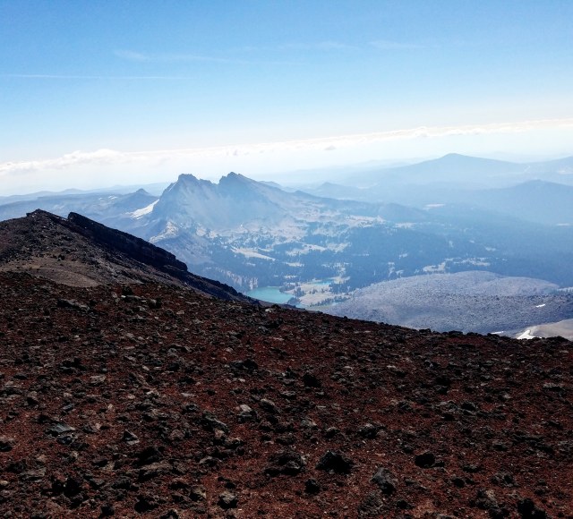
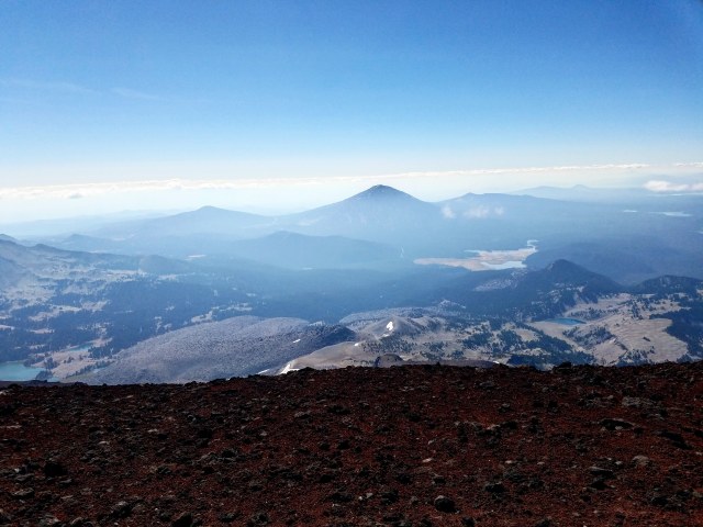
To the east, beyond the lake, I could see the jagged peak of Broken Top, backlit by the morning sun.
Hunter Breckenridge – 2018
The plateau gained and lost elevation, but was fairly flat – significantly moreso than the forested section that started my journey.
Hunter Breckenridge – 2018
The trail became more exposed, as the plateau turned into a narrower ridge.
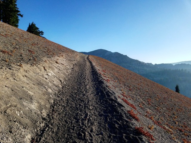
Hunter Breckenridge – 2018
The trail surface was a soft, dust-gravel mix that reminded me of a really terrible softball field I played on a decade ago.
By this point, I had shed my jacket, as I was sweating profusely, but the wind was sharp enough to keep the hoodie on for the time being.
Hunter Breckenridge – 2018
Sometime around 8:30, the plateau section was clearly ending, and the trail started getting steep again.

Hunter Breckenridge – 2018
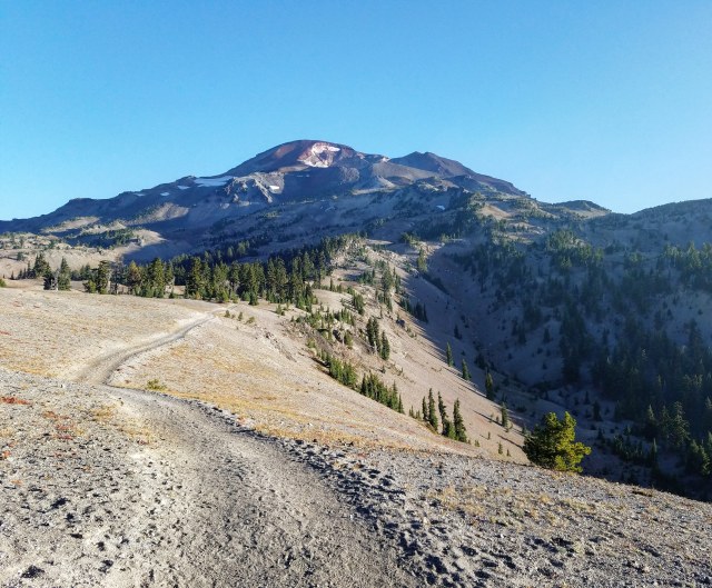
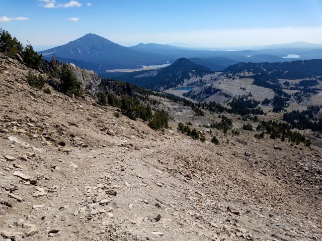
The trail was at times soft and dusty, but also littered with rocks. The going wasn’t incredibly slow yet, but I was feeling the altitude some. As the plateau ended and the steep stuff begun in earnest, I was around 7,000 feet, up from 5,000 feet at the start of the hike.
Looking back the way I came. Mt. Bachelor can be seen in the distance. – Hunter Breckenridge – 2018
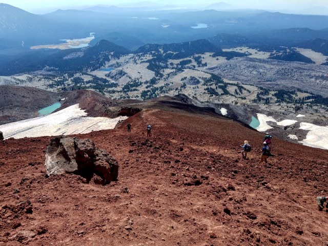
At points, the trail seemed to branch off in different directions, and even briefly disappear, though there were no shortage of footprints providing some idea of where to go. Looking back the way I came, I could see the trail pretty clearly, which strangely made it easier to then locate where it picked back up above me. When the trail vanished, I had to scramble over some rough scree, and even some boulders on a few occasions.
At around 9:15, after some scrambling over a steep section of boulders (maybe 300 feet of elevation gain over about 800 – 1,000 feet of total distance), I found myself back on a recognizable trail. I had reached a spot that I would later hear referred to as “the false summit.”
Indeed, the actual peak of the mountain had disappeared from view more than a half hour before, and it had seemed like I had been making real progress. A pair of hikers I encountered back on the plateau had stuck near me for the last mile, and all three of us grumbled cheerfully at what loomed ahead.
Hunter Breckenridge – 2018
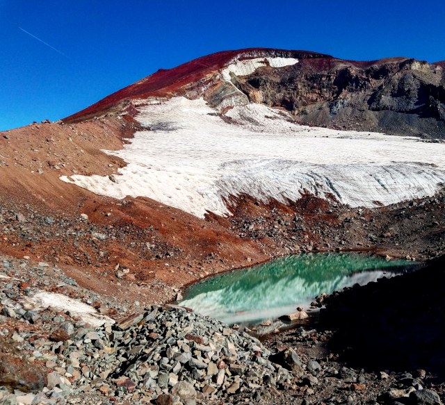
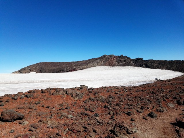
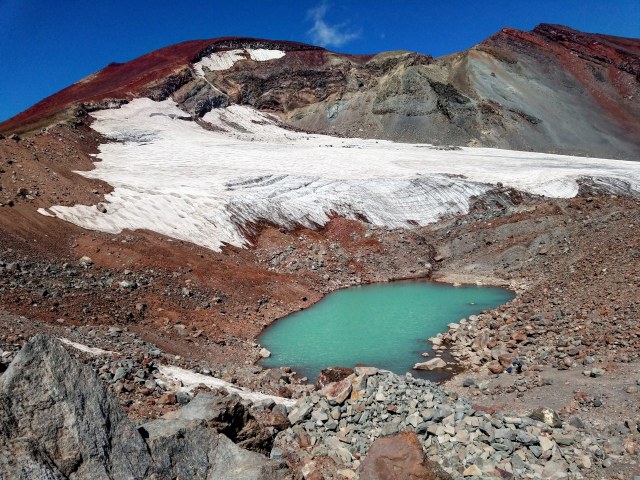
At the base of the final push was a beautiful green lake, resting at the base of the Lewis Glacier, a thousand-foot chunk of ice carving out a massive indentation in the slope of the mountain. To the left was an exposed ridge with the trail running up. And up. And up.
Hunter Breckenridge – 2018
I started up the slope. The trail was thick, soft scree that occasionally splintered and turned into multiple paths that eventually reconverged. It wasn’t too difficult to stay on the basic path, but the going was slow, thanks to the steepness, the altitude, and the material of the ground. I slipped some, but my boots were able to dig in fairly well. The trekking poles helped.

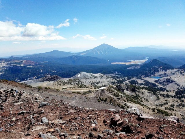
Broken Top and Bachelor in the distance. – Hunter Breckenridge – 2018
The path was really just a tiring slog. The views were inspiring – which helped, because my progress continued to be… um, glacial, and I had to stop and catch my breath every few hundred feet.
Hunter Breckenridge – 2018
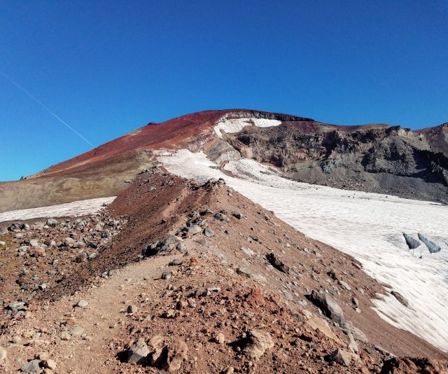
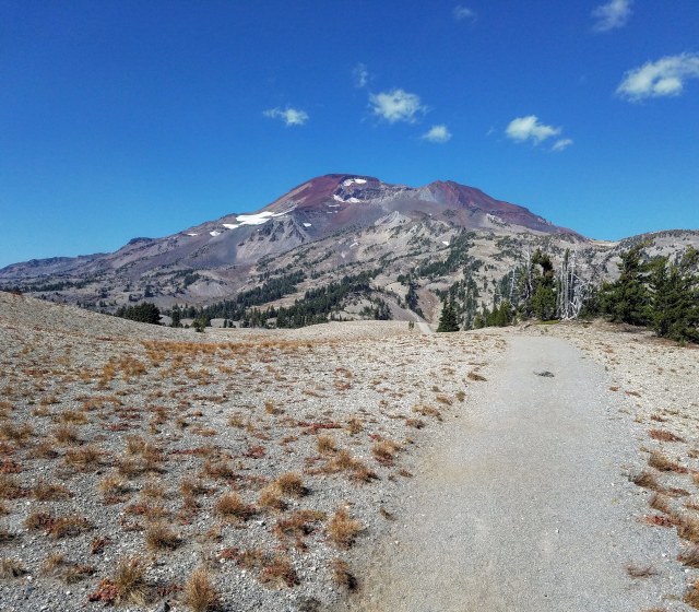
The muscles in my legs were starting to spasm. I was beginning to have doubts I would even make it to the top. The scree became heavier, turned red, and the trail became more rock-filled. Finally, I could see the crater rim just a couple hundred feet above. The trail more or less disappeared, and from there, it was just a tough rock scramble.
At 10:56, I finally staggered up to the edge of the summit crater, gasping and wheezing all the way. Looking back down, the base of the mountain seemed absurdly distant.

Hunter Breckenridge – 2018
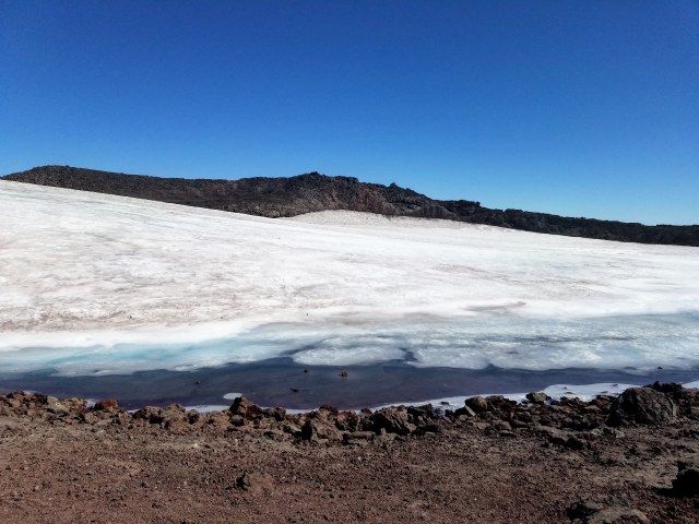
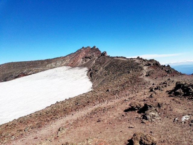
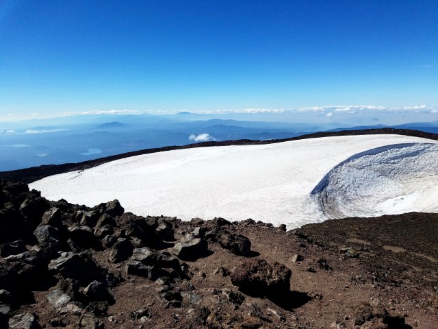
Turning back toward the crater, I could see a massive bowl, maybe a quarter mile across. It was filled with snow and ice. Almost directly across the bowl was a rocky ridge, a hundredish feet above the snowfield. That was the summit. I could see a handful of ant-like figures clambering around on it.
Hunter Breckenridge – 2018
To my right and left, a trail appeared to wrap around the crater rim. I could either hike around the crater, or try my luck across the frozen lake. I didn’t trust my energy or balance to make that attempt. The crater rim would be fine. I went right. The views off the edge of the rim were more than worth the effort it took to get there.
Hunter Breckenridge – 2018
I stopped and chatted with a hiker who I encountered earlier on the trail, but had powered past me on the final stretch. He was enjoying a well-earned snack, and enjoying the view. Apparently he didn’t feel up to clambering up to the true summit. We chatted about other hikes in the area, and then I bid him adieu, and pressed on.
It’s farther away than it appears… – Hunter Breckenridge – 2018
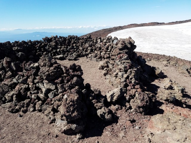
I took my time around the crater, stopping to take photos every time the view inspired me – which was often. Along the east side of the rim were a series of wind shelters made of stacked rocks, in U-shaped patterns. Nobody had tents up at that point, but it appeared to be a setup for summit camping.
Hunter Breckenridge – 2018
Hunter Breckenridge – 2018
The trail finally disappeared a few hundred feet from the summit. Some light scrambling was necessary to get to the actual top of the mountain. I was tired, but there was no way I would turn back now.
Finally, just before 11:30, I stepped up to the summit of South Sister. There was a small USGS reference mark just below a pile of rocks that marked the official high point.
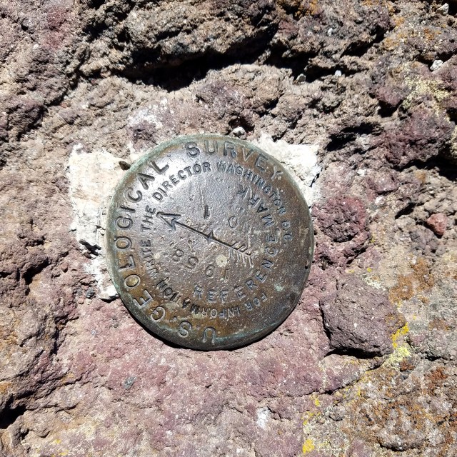
Hunter Breckenridge – 2018
There was a group of hikers lounging on the summit when I arrived, although they shoved off pretty quickly after I got there. I know I looked pretty rough, but I’m assuming I wasn’t scaring them away.
Looking back across the frozen crater lake, I could see more hikers dragging themselves up on the rim.
Hunter Breckenridge – 2018
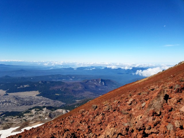
The views around the crater were all amazing, but the real gem was on the north end, off the true summit. To the northeast was another great view of Broken Top.
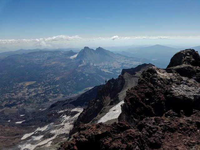
Hunter Breckenridge – 2018
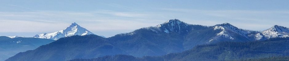
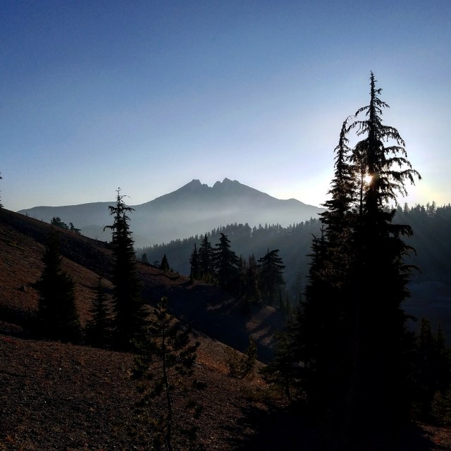
And to the northwest were the other Sisters, Faith and Hope, looking jagged and ominous.

Middle and North Sisters – Hunter Breckenridge – 2018
Far beyond the North Sister I could make out Mount Jefferson, though it didn’t show up well with my cell phone camera.
I did manage a now-obligatory selfie… at least to prove to myself in the future that I actually did this.
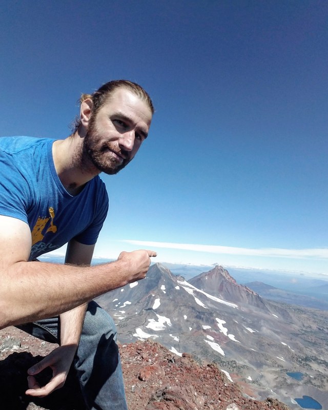
It’s me! – Hunter Breckenridge – 2018
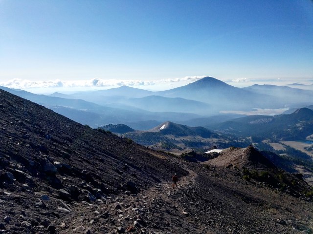
After about half an hour, some water, a sandwich, and a bunch of photos, I decided it was time to depart the summit. Also, another round of hikers was showing up, and I was hoping for a bit more solitude. I considered continuing around the rim in the direction I hadn’t yet tried… but I couldn’t clearly make out the trail at points, and I wasn’t feeling that adventurous. So, I headed back the way I came. By around 12:20, I was back at the crater rim, looking down.
Well, first, admiring the view more out than down.
Hunter Breckenridge – 2018
And then down. Way down. I could see the trail along the plateau far below.

Hunter Breckenridge – 2018
As I started down, I immediately noticed a couple of differences.
The trip down was far less taxing on my leg muscles and my overall stamina than heading up. I wasn’t breathing nearly as hard.
However, it was hard to balance on the steep scree, and I kept slipping.
After some trial and error, I developed a technique on the steeper sections. I angled down, somewhat sideways, with my right foot forward and pointed slightly to my left side. Using my trekking poles for balance, I would sort of skid down a few feet at a time, pushing with my back foot here and there. It wasn’t pretty. I must have looked like an enormous, drunk praying mantis. But the locomotion was reasonably efficient, and as I made my way down the ridge alongside the Lewis Glacier, I made decent time.
Hunter Breckenridge – 2018
Taking a break to glance back after 30 minutes or so, I could see how much ground I had covered.

Hunter Breckenridge – 2018
The views continued to be spectacular, even from increasingly lower elevation.
Hunter Breckenridge – 2018
I eventually returned to the lake at the bottom of the glacier. I could see hikers milling around next to it.
Hunter Breckenridge – 2018
From that point on, it was just a slow, increasingly warm afternoon, gradually heading down the hill. I lost the trail a few times, and had to scramble off the false summit very carefully, but on the whole, it was a smooth and enjoyable experience.
Hunter Breckenridge – 2018
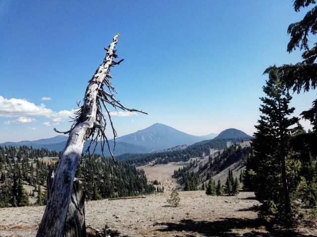
Just before 3 in the afternoon, I returned to the plateau region, and started my stroll to the forest and the final section.
Hunter Breckenridge – 2018
The sun felt harsh, although it wasn’t oppressively hot at this point. The bright light did provide some stunning views, however.
Mount Bachelor loomed ahead.

Hunter Breckenridge – 2018
Broken Top sat to the east, no longer backlit like it was in the early morning, but occasionally covered in shadow from passing clouds.
Hunter Breckenridge – 2018
And directly behind me, the bulk of South Sister watched over me as I walked away from her.
Hunter Breckenridge – 2018
I got a good look at Moraine Lake shortly before I dipped back into the woods.

Hunter Breckenridge – 2018
As I headed toward the trailhead, I came across several groups of campers hiking to the lake, to stay the night and take a shot at Charity the next morning.
As I dove into the forest, I found myself decompressing. This was a good day. So good in fact, that I’m now second-guessing whether or not I want to make this my last major hike of the summer. Maybe Mount McLoughlin or Mount Bachelor in a couple weeks?
Regardless as to what I decide, I’m glad I made this decision. The sunburn is taking days to heal, and my legs are still sore, but I would happily do this again. If one is willing to spend most of a day dragging themselves up a giant rock for the chance of some thin air and ridiculously gorgeous scenery – I recommend it. Also, it’s apparently wise to avoid weekends. I went on a Friday, and while it wasn’t crowded, I was rarely alone after 10 am or so. Take a weekday if isolation is ideal.

Pingback: Hiking Report – Battle Ax Mountain | A Skewed Perspective
Pingback: Hiking Report – Mount McLoughlin | A Skewed Perspective