This is my account of my hike up the Mount Defiance-Starvation Ridge Loop – or, how I learned to stop worrying and drag myself up and down a really big hill.
So, I promised to do this one again. Well, this blog feature.
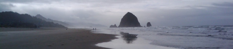
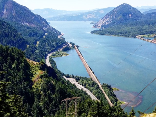
The Dog Mountain hike back on my birthday got that hiking bug going again. I’m hooked, and I need my fix. Fortunately, the peak of the last one provided a great view of my next target.
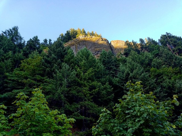
Right across the Columbia River, just an hour(ish) east of Portland, sits the hulking mass of Mount Defiance, the remnants of an old shield volcano looming up against the river.
Mt. Defiance has a reputation for being a particularly grueling hike – arguably the toughest in the Columbia River Gorge. Naturally, this intrigued me. After all, Dog Mountain was reported to be somewhat taxing, and I handled it fairly well, so what’s so hard about a longer version of the same thing?
Yeah, you can see where this is going.
First of all, it’s amazing what just a couple weeks of time can do to insulate one to the memories of hardship. The Dog Mountain hike wasn’t the most intense I’ve experienced – but it wasn’t easy. My leg muscles were sore for days after, and my ankles are still experiencing twinges from when I kept rolling them on the way down. A lot of that was due to my lack of conditioning – but also – these hikes aren’t easy.
And Mount Defiance was significantly harder than Dog Mountain. Those who said it was a rough one weren’t joking. Naturally, what I really wanted was the longer version of the hike – first up Mt. Defiance along the Mt. Defiance Trail, then back down along the Starvation Ridge Trail, creating a nearly 13 mile loop. Almost 5,000 feet of gain, followed by 5,000 feet back down. It sounded a bit daunting, but mostly just fun. And again, with the hard parts of Dog Mountain fading into memory, the daunting aspect wasn’t my primary concern.
Overconfidence is a silly thing.
Anyway, let’s get into it.
Last Saturday, (Happy Bastille Day!), I drove east along the Columbia River, and arrived at the Starvation Creek Trailhead, about 50 minutes from downtown Portland. It was 6:30 in the morning, and the parking area was quiet. There’s a decent bathroom facility at the site, with a water fountain. There are multiple trails that lead off from the trailhead, but the one I wanted led down along the highway, back the way I came.

Hunter Breckenridge – 2018
I tightened my boots, stuffed my pockets with protein bars, strapped on my water pack, and posed dramatically. Well, for a moment. Then I looked around self-consciously, because I realized I looked really silly.
And I started off. Down the path I went!

Hunter Breckenridge – 2018
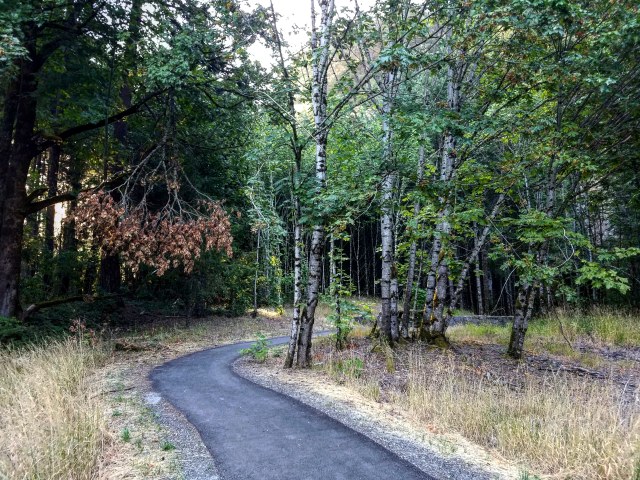
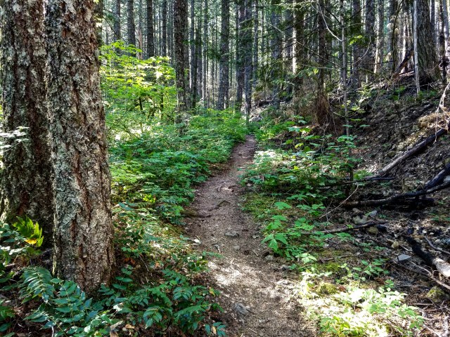
Um, the paved, level path, running along a major highway. Huh. Well, the Defiance trail runs about a half a mile along the road, shaded with trees. It feels like an urban park for a short while. It’s almost idyllic.
After a short distance, I came across another path connecting with this one. It came from the woods to my left, and is currently blocked off with barriers and signs, warning of danger.
That’s a good point to briefly segue here. Late last summer, the Eagle Creek Fire burned around 50,000 acres of forest throughout the Gorge. A 15 year old was playing with fireworks during a particularly dry time of the year, and… well, the kid screwed up. Even now, 10 months later, many trails and hiking areas are still closed to the public. The eastern border of one of the closed zones is literally my southern leg of this hike. So it made sense that other parts of the trail might be closed.


Now, the section in question was the Starvation Ridge Cutoff – which would come up for me later on. But for now, scary signs told me to keep out. I wasn’t heading that way anyway, but it was a glaring reminder of the damage that can be done by a single careless person. So kids, listen to Smoky the Bear, or something.
I carried on down the nice clean path that wasn’t burned to a crisp. As I walked in the early morning light, enjoying temperatures in the low 50s Fahrenheit, I heard a loud screech over my head. It took me a second to realize what I was looking at, but there was an actual bald eagle soaring past me, heading along the path before veering right toward the river. The thing was huge! I wasn’t sure whether or not I should salute, or alert the FAA.
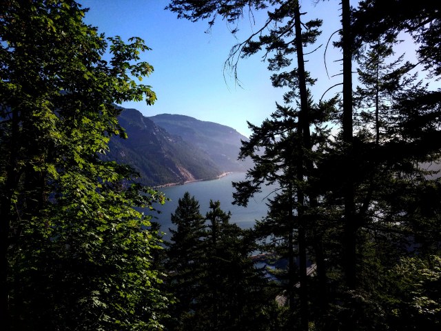
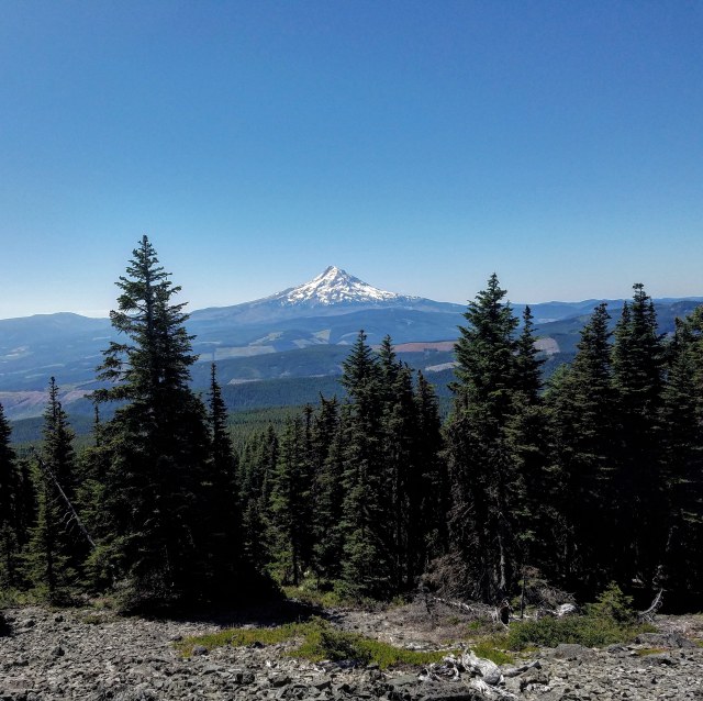
I looked up past the eagle, and got a glimpse of my immediate future. The mountain loomed over me.
Hunter Breckenridge – 2018
Further down this path, on the left side, was my first waterfall of the hike. Cabin Creek Falls, a multi-tiered, 220 foot fall, was partly hidden by a huge boulder, that created a natural enclosure for the pool at the bottom.

Hunter Breckenridge – 2018

Hunter Breckenridge – 2018
Finally, after the surprisingly long jaunt along the highway (still at river level), the path veered off to the left, away from I-84 and into the woods.
At this point, there still was no significant elevation change. The pavement remained for another few hundred feet, when the path passed through a picnic area.
A lone hiker passed me coming the other way, looking pretty disheveled. I hoped that it wasn’t a sign that the trail would be overly crowded. I also hoped it wasn’t a sign I would look that rough by the time I reached the end.
Past the picnic area, the trail continued feeling like an urban park.
Hunter Breckenridge – 2018
Finally, the trail got interesting, as I came up on my second waterfall of the day.

Hunter Breckenridge – 2018
Hole in the Wall Falls, a 95 foot high man-made waterfall loomed behind a small wooden footbridge.
This particular waterfall was created as a tunnel diverting water from Warren Creek higher up the mountain, to prevent the creek from damaging I-84.
Considering it was created back in 1938, it seems like a fairly impressive piece of engineering. But more importantly, it acts as a lovely backdrop, as well as sort of a gateway to the serious start of this hike.
Because as soon as I crossed the footbridge, the path turned rougher, and became far more vertical than what I’d been experiencing. After a short while, I found myself

Hunter Breckenridge – 2018
in the powerline corridor. The Starvation Ridge Trail junction came into view. This was

Hunter Breckenridge – 2018
where the return leg of my journey would meet back up with this part of the trail.
According to the really handy guide on oregonhikers.org (they aren’t paying me, I swear), this was where the real fun was about to begin.
Well, pretty soon. The steep switchbacks where still a few minutes away.
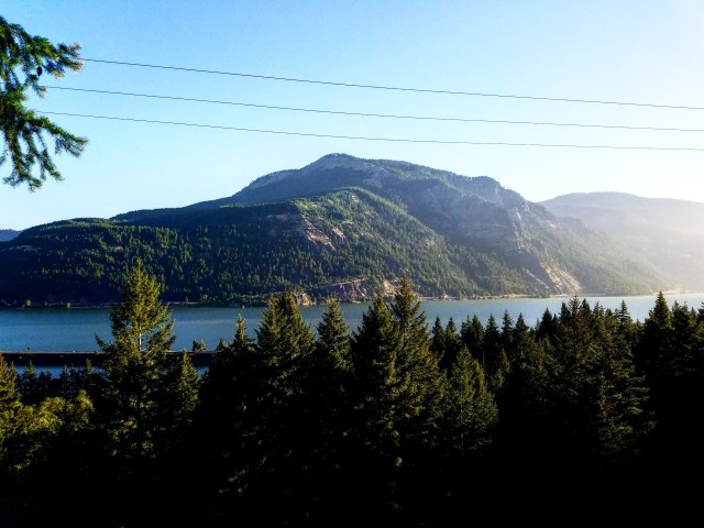
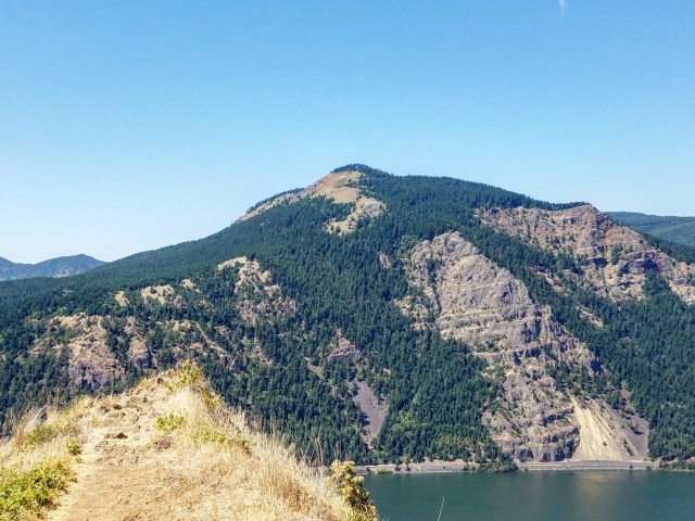
And as I entered more exposed parts of the path, I got some great views of the Columbia River Gorge, including my old pal Dog Mountain, over on the Washington side. In the early morning light, there was a serene quality to the view that I can’t quite articulate.
Hunter Breckenridge – 2018
After gawking at my old friend, I had one more waterfall to contend with.
I came upon Lancaster Falls, another two-tiered waterfall system. This one was technically the largest of the three, but from my vantage point, I could only see the relatively short (maybe 20 feet) lower tier. The 250 foot high upper tier was apparently best viewed from a weigh station about 200 feet below me. Well, that wasn’t an option.

Hunter Breckenridge – 2018
You know what else wasn’t an option? Staying dry.
So, to backtrack slightly, I was spoiled by the Dog Mountain hike. Other than a brief issue in the woods on the far side of the summit, I never had a problem staying on the trail there.
Mount Defiance, I quickly learned, was a bit different. Technically, the trail I was taking this day runs as a complete loop up the mountain, around the summit, and then back down along Starvation Ridge. But there are spots when the trail seemingly disappears, and one had to clamber around on rougher terrain to locate the trail on the other side. Further up the mountain, this took the shape of talus fields, which I’ll be talking about later. At this point, it was the 50 foot (or so) wide basin of Lancaster Falls. I was annoyed at myself as I spent probably five solid minutes bouncing around on the east side of the basin, trying to find the spot the trail continued. After some time, feeling embarrassed despite being alone, I noticed the trail picked up again – past the boulders and ankle-deep pools underneath the falls. There was a slight slope to the basin, and I suppose a reeealllly reckless person could find themselves slipping and sliding to the edge, which would result in a briefly exhilarating fall into the trees below. But I was cautious, and tend to enjoy not dying on a rock in rural Oregon. So I eased my way across, and picked the trail back up on the other side.

Hunter Breckenridge – 2018
It wasn’t long before I would get one final gorgeous view of the Gorge looking west, and then the switchbacks finally started. From there, the trail started it’s winding path south to the summit.
And from then on, I just went up.
And up.
And up.
Oh yeah, did I mention I went up?

Hunter Breckenridge – 2018
I don’t believe I’m in terrible shape, but I’m also not exactly at my best. Plans to ramp up my cardio pre-Dog Mountain were halted after tearing up my ankles on that hike, and I haven’t really picked it back up since. So it wasn’t long before my breath was ragged, my heart felt like a drum solo in my chest, and my legs were burning.
And I was having an absolutely marvelous time. I wasn’t keeping count, but according to the trail guide and my GPS, there were something like 21 switchbacks over the next mile. My still-sore legs (eight days later!) can believe it.
Hunter Breckenridge – 2018
Occasionally, I would get a glimpse of the Gorge through the trees.

Hunter Breckenridge – 2018
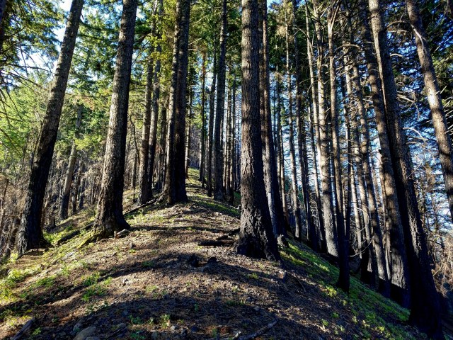
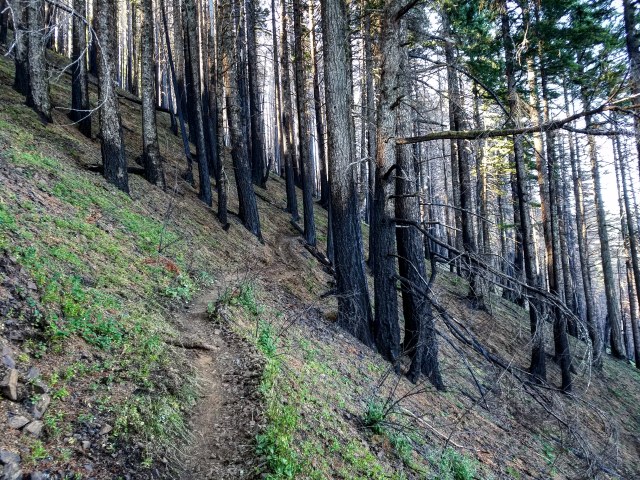
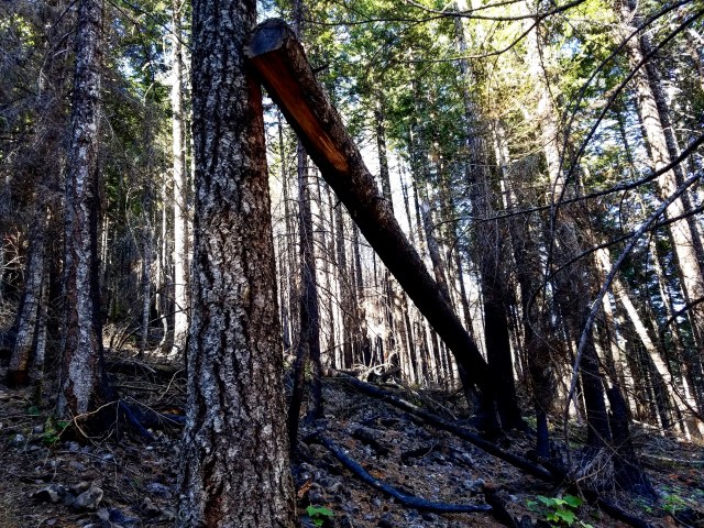
The trees themselves were gorgeous. Although around switchback number six or seven, I started to notice burn damage on many of the trunks.
There were also plenty of trees on the ground, although not so much that it badly disrupted overall coverage. From what I could tell, most of the fire that burned through this section was ground fire. There were some trees felled, but for the most part it resulted in scorched trunks, but still living trees.
Sometimes I would have to hoist myself up and over a log blocking the path. Sometimes the logs were blackened and charred. I’d pull my hand away and realize that it turned black from the carbon residue. I remember at one point taking a selfie and realizing there were black smudges on my face where I wiped away sweat using my charcoal hands.

Hunter Breckenridge – 2018
This log provided me a nice step instead of making me vault over.

Hunter Breckenridge – 2018
A little before 8 am, the switchbacks became less tightly packed, and the slope itself gradually turned less drastically steep. There was less exposure, and the surface felt more like a hill and less like a cliff.

Hunter Breckenridge – 2018
I finally took my first break at around 8:10. I tore into a protein bar and took in the sounds of the birds.

Hunter Breckenridge – 2018
After I stopped moving, I was able to pay more attention to the wilderness around me. By this point, I could no longer clearly hear traffic along the highway.
As I paused, it felt like I was first really paying attention to the fact that I was no longer near “civilization.”
I could see what appeared to be a blue jay, yelling at a squirrel.
A chipmunk saw me and dove under a nearby log.
It’s really amazing what one can observe just by being still and quiet. I think people miss a lot as they go through the bustle of their daily lives. I know I certainly am one of those poor souls… at least much of the time.
Sitting on a log in the woods, with only the sounds of nature around me… it was a clarifying experience. I took so much in that didn’t involve other people, or traffic, or glowing screens.
For a little while, I couldn’t move, because I didn’t want the feeling to end.
Also, my legs were tired.
Hunter Breckenridge – 2018
Anyway, eventually, I dragged myself up off the log, and started trudging back up the mountain. By this point, it was around 8:30, and the slope had straightened out and was heading pretty directly south.
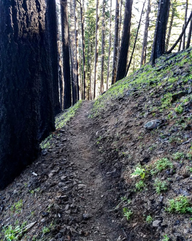
By 9 am, the trail was growing steeper. It was curving through the trees, and with the ash on the ground, felled branches, and lots of leafy debris, it was a little hard to follow for a few minutes.
Hunter Breckenridge – 2018
Hunter Breckenridge – 2018
Hunter Breckenridge – 2018
Not completely sure how this log was staying in this position… Hunter Breckenridge – 2018
I was getting tired, and having to take more breaks. I also realized I may not have filled my water pack as far up as I should have, because even though I was trying to sip from it at a measured pace, it was already running low.

Hunter Breckenridge – 2018
And in the distance behind me, I could start to hear voices. Two hikers were coming up behind me, punctuating the solitude. I could feel myself growing irritated, though much of that may have been fatigue and annoyance at my own lack of preparation.
Still, I wasn’t making terrible time, and I knew I was getting within around a thousand feet in elevation from the summit. Distance was still at least a mile, though.
I continued on. Even though I was dripping with sweat, there was enough of a breeze coming through the trees to keep me from feeling overheated. And I still had enough food and water to keep my going for the time being. I mean, it was just supposed to be a dayhike. I wasn’t on a Himalayan expedition. Not yet, anyway…

Hunter Breckenridge – 2018
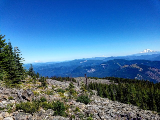
Finally, after rounding the bend on a particularly steep and narrow corner, I came out into a clearing. Forgive the language, but holy shit, was the view incredible. From the northwest corner of the mountain, a bit below the final summit, I could see… well, everything. To the northwest was a clear view of Mount St. Helens, looming in her volcanic, intimidating way. To the east from there was Mount Rainier. I hadn’t realized that I could see that far… and indeed, it was clearly more distant than St. Helens. But there it was. And then, further east still, was Mount Adams, looking pretty much exactly the way a mountain should look. Snow-covered, bulky, but still graceful.
These next few pictures will hardly do the views justice. My battered Samsung phone is hardly a substitute for one’s eyes. But it’s worth posting:
From left to right – Mount St. Helens, Mount Rainier, Mount Adams… Hunter Breckenridge – 2018

Mt. St. Helens – Hunter Breckenridge – 2018
As I stood admiring the view – and maybe catching my breath, the voices that had been growing louder behind me came around the corner.
Two other hikers came bounding up. Both were significantly younger and in better shape than I was.
Sort of like how I felt back on Dog Mountain a few weeks back, my irritation with having to share the

Mt. Rainier – Hunter Breckenridge – 2018
mountain with others faded as I actually interacted with them. My introversion is a powerful force – in my own brain. But now and then, people don’t suck quite as hard as I make them out to in my mind.
So, after a very pleasant chat, commenting on the scenery, as well as discussing other hikes, my two fellow hikers moved on, while I scrambled around on some boulders,

Mt. Adams – Hunter Breckenridge – 2018
trying to force my phone into taking better photos.
Also, I may have used that amazing photo-op as an excuse to take yet another break.
Finally, I bid the clearing adieu, and set off after the now-fading voices.
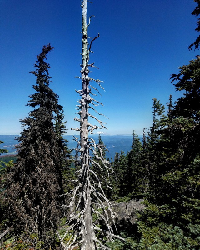
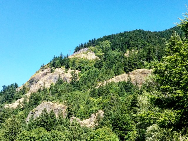
The trail started to narrow, and was winding its way through thick brush. The dirt path ran into a massive rock field. In the climbing parlance, the fields are called talus. Except when they’re called scree. Or something like that. Anyway, I think these were talus fields. Also, along with the loose rocks covering the slopes, the trees were becoming more sparse.
Hunter Breckenridge – 2018
A little before 11, I came up to the final summit trail, a junction that formed a loop around the summit, and joined back together. I decided to go right, because the guide page said it was longer, prettier, and more difficult. In theory, that would mean the way back would be easier, which I could probably use by that point.

Hunter Breckenridge – 2018
Now would also be a good time to mention that both the fly and bee population of Mt. Defiance were… substantial. And every time I’d hunker down on a rock or log to take a breather, I would feel/hear dozens of the little suckers buzzing around my ears. It wasn’t completely intolerable, but it was annoying.
But I digress.
By 11:00, I was firmly on the big talus fields that covered the west side of the summit. It was bright, exposed, and a bit unnerving. Also – it was gorgeous to see. I’m glad I decided to take the full loop around the summit, because I wouldn’t have wanted to miss this.

Hunter Breckenridge – 2018
There were a couple sections of the talus that had paths built in, but there were a couple others that were just the boulders, and I had to scramble along them until I figured out where the trail picked up on the other side.
It was about this time, as I stopped to admire Mount St. Helens to the northwest, that another hiker overtook me on the boulders. At least twenty years older than me, with a pair of hiking poles, he appeared to move slow and robotically… but somehow was ripping along the rocks without a sign of stress. If I weren’t annoyed at being passed by an old guy, I’d be impressed.
Hunter Breckenridge – 2018
So, as I tried to shove away my own neuroses, nature once again decided to work its magic in distracting me.

Hunter Breckenridge – 2018
I lurched around the bend, now on the south side of the summit loop. And there was Mount Hood, being the perfect mountain once again (sorry, Mt. Adams, I still love you).
I paused on yet another talus field, just above a massive forest, and took in the sight of Hood. I’m normally used to seeing the mountain from the other side – and a bit further away. This was a nice change. One day, I’d like to get a crack at Hood, but since Mount Defiance was kicking my ass on a dayhike, I’d imagine it will be some time before I’m ready for that one.

Hunter Breckenridge – 2018
Eventually, I pressed on, now turning back north to the summit. And, at exactly 11:16, the summit came into view, where I was greeted with… a radio tower and fenced-off communications compound, complete with a gravel access road. Yeah, that takes away a bit of the romance from the journey.
But there were a bunch of boulders on the south end of the summit, and sitting on them allowed me to relax and enjoy lunch while gazing at Mount Hood. The three climbers that passed me were all on the rocks, enjoying a well-earned break.
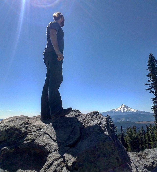
Me on the summit of Mount Defiance – Hunter Breckenridge – 2018
After nearly five hours and six and half miles, I had done it. Well, half of it. I was at an elevation of either 5,010 or 4,959 feet, depending on the source.
By 11:30, other hikers were arriving at the summit. My goodwill toward other human beings was starting to diminish once again. So I bid farewell to people who would doubtless pass me up again soon, and wandered around the back of the communications compound to pick up the northbound summit loop, and headed back down.
The route down somehow felt steeper. Some of that was fatigue, I’m sure. Also, I had run out of water, and was really wanting to get back to a water fountain.
It took about an hour, but the steepness eased a bit, and I came up on Warren Lake. Campsites dotted the shoreline. The view was tranquil and quite lovely.
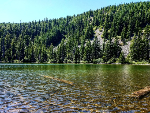
Hunter Breckenridge – 2018
It also gave me a chance to wash off my charcoal-covered hands and face. Priorities.

Hunter Breckenridge – 2018
Moving on northeast from the lake, the path was fairly flat for nearly a mile. I came across a junctions for other routes, and after some time, the trail began dropping faster once more. I was heading more or less north, back to the Columbia.
My legs were getting sore, and balance was increasingly shaky. I wasn’t turning my ankles like I was going down Dog Mountain, thanks to better-laced boots and ankle braces – man, I’m getting old. But I was feeling run down. The hike wasn’t THAT long, but even with the gorgeous scenery, it was feeling more like a slog.
Hunter Breckenridge – 2018
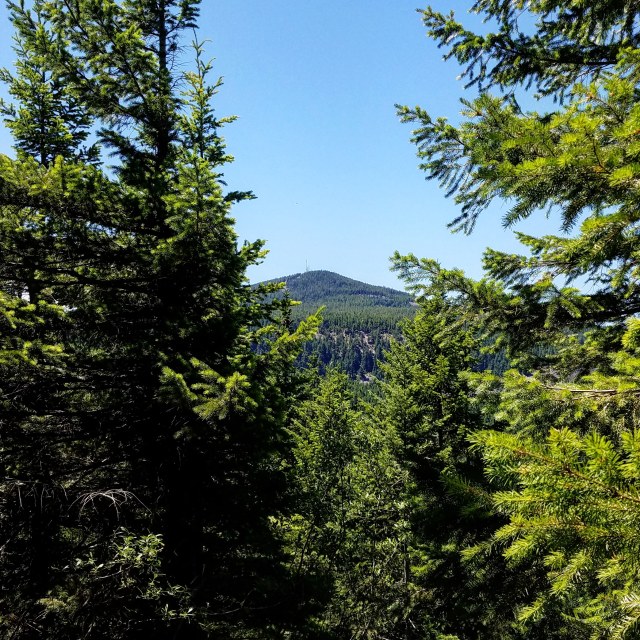
At around 1 pm, I got a glimpse of the peak of Defiance through the trees. Several large talus fields lay beyond, paths only marked by large cairns. My clumsiness made some of the scrambling rather interesting. But I survived, and continued hobbling along.

Hunter Breckenridge – 2018
By 2 pm, I was hitting some tight switchbacks. A lone trail runner came zipping past me. He gave a brief hello, and kept jogging. He was the last person I would see until I got back down to river level.
Around 2:20, another massive talus field beckoned.
Only this one had an incredible view about halfway across.
I hunkered down on a rock for yet another break, and took in the sight of Mount Adams, posing majestically to the north, dominating the skyline of southern Washington. It was magnificent.

Hunter Breckenridge – 2018
After that was just a long, steep, winding drop through the woods. The views largely disappeared, as the path sunk down in between the valleys.
I staggered on for another hour or so. My mouth was dry, I was drenched in sweat, and my left knee and right ankle were both giving me grief. I was still enjoying myself, but lamenting my lack of conditioning. And I was moving slllllooooow.

Hunter Breckenridge – 2018
A little past 3:30, I stumbled into a clearing. Well, make that the top of a cliff. Here I was, back at the Columbia River. Or, about 1,400 feet above it. At the top of the field was a massive powerline structure. I could hear something screeching at the top of the framework. It took me a minute to locate, but when I did, I realized I came across an osprey nest. And Mama Osprey made it clear I wasn’t welcome. I tried to move quickly underneath the power lines to pick the trail back up.

Hunter Breckenridge – 2018
I looked down to catch a great glimpse of the Gorge below, as well as the exposed switchbacks that would take me down for at least the next 400 or so feet.
The osprey kept swooping down close to my head, so I made a beeline for the trail, and motored for the first switchback, hoping she would chill out once I got down below the top of the cliff area.
Fortunately, that did help, and she went back to the nest. Meanwhile, I was feeling increasingly off-balance and tired. The view below me was spectacular, and just a bit unnerving. Also, across the Gorge was a clearer view of Dog Mountain. Of course, Dog Mountain is “only” 2,900 feet from top to bottom, but it was a cool moment to look at a massive formation and be able to say to myself, “I climbed that.”
Hunter Breckenridge – 2018
Dog Mountain – Hunter Breckenridge – 2018
After snapping out of my self-indulgent reverie, I continued staggering down the hill.

Hunter Breckenridge – 2018
The exposed section finally dove back into the trees, giving me much-needed shade.
I could hear I-84 clearly now, and I thought I could make out the sound of one of the waterfalls.
Naturally, every time I managed a glance through the trees down to the river, it still seemed like it was miles away. My glacial pace lurching down the trail wasn’t helping matters.

Hunter Breckenridge – 2018
Finally, I came up on the Starvation Ridge Cutoff Trail Junction. This point, around 600 feet above the river, would represent a significant shortcut to my return journey.
Naturally, it was closed.
I will admit to being tempted to try to rush the return, braving whatever hazards lay beyond. In the back of my fatigue-addled mind, I figured if I came up to an obstacle I didn’t think I could clear, I would just turn around and take the long way home.
On the other hand, I like living and all that. If the Forest Service or whomever thought it was important to close the cutoff at both ends, it probably wasn’t worth saving half an hour if it also meant risking a nasty fall.
So, a deep sigh, some grumbling, and I turned around and took the long way, back west parallel to the river, and around and down.
Can you see the power lines with the osprey nest? – Hunter Breckenridge – 2018
At around 4:30, I found myself back on the paved road, strolling along the highway. It made for a nice cool-down period, as I moseyed back to the parking lot at the trailhead. It took me around 10 hours to stumble around 13 miles, as well as 5,000ish feet up and 5,000 feet back down. There are people in better shape who could (and did!) do it in half the time. But for someone only just getting back into serious hiking, I felt accomplished.
As I was driving back home, I didn’t want to think about clambering around on rocks again for awhile. However, a week later, I’m already preparing for the next one. Ideally, I’ll be getting into better shape for future hikes, too.
Tentatively, the next couple hikes will be Silver Star Mountain in Washington, and Saddle Mountain on the Oregon coast. I’ll probably be boring people with my experiences (and photos) from those hikes as well.

Pingback: Hiking Report – Saddle Mountain | A Skewed Perspective
Pingback: Hiking Report – Silver Star Mountain | A Skewed Perspective
Pingback: Hiking Report – Battle Ax Mountain | A Skewed Perspective
Pingback: Hiking Report – Mount McLoughlin | A Skewed Perspective
I have done that hike half a dozen times over the last 20 years. I’m 71 now. It is a tough hike. Climbing Dog Mountain before Mt Defiance gave you a fitness advantage. It sounds as though you should take a water filter with you if you aren’t already doing so. I enjoyed your adventure and photos.