
We’re already near the end of July 2019, and I haven’t posted a hiking report yet this year. In fact, I haven’t posted one since my trip to Battle Ax in October of last year. This year I have journeyed to a couple mountains already, but neither one was particularly worthy of a report.
On May 3, in a spur-of-the-moment decision, I made an attempt at Thunder Mountain about 10 miles north of Battle Ax, and was unfortunately thwarted by snow and downed trees on the road to the trailhead. I tried hiking down the road around 3 miles through the snow to the trailhead, but ended up giving up when I realized how much time I was taking just to get to the starting point. I did enjoy some nice views of Battle Ax and Mount Jefferson, but the hike itself was a disappointment.
On June 21, I made another run up Mount Defiance, a little less than a year after the last time I hiked it. This hike was successfully completed, however, the day was mostly overcast, and the really good views of the big Cascade peaks were consistently obscured the entire time.
Defiance was really meant to be a warm-up for my first big hike of the year, anyway. Back during the winter, I mapped out a schedule of possible hikes for 2019. I wanted to challenge myself more than last year, and I wanted to take on some of the higher Cascade volcanoes. I didn’t think I was quite ready for the likes of Hood or Jefferson, though. So, after careful research, I settled on Mount McLoughlin as my first big climb of the year.
Standing at the southern end of Oregon, just 30 miles or so north of California, the trailhead for McLoughlin can be reached in a little under five hours from Portland. I decided to drive out after work on a Thursday, stay the night near Medford, and drive to the trailhead early the next morning. I hoped that a weekday, even a Friday, would be less crowded than a weekend.
I chose McLoughlin for a variety of reasons. It’s a relatively short drive from home, it’s not a technical climb I might not be ready for, and it’s tall enough and difficult enough to feel worthwhile. At 9,495 feet, Mount McLoughlin is the 10th highest mountain in Oregon, and the 6th most prominent. The hike is around 10 miles out-and-back, with just under 4,000 feet of elevation gain. It’s more or less an 80% version of South Sister.
I arrived at the trailhead a few minutes before 7 am on July 19. It was overcast at that point, but the forecast called for clear skies within the following hour or two, so I wasn’t overly worried.
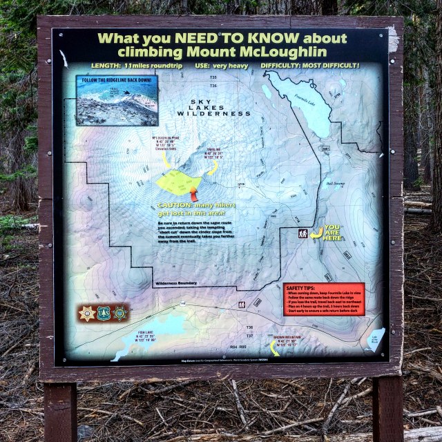
There was a vault toilet and some warning signs about not being dumb and getting lost on the mountain. Also a decent amount of parking space. After a brief inventory check, I got my pack together and set off down the trail.
Hunter Breckenridge – 2019
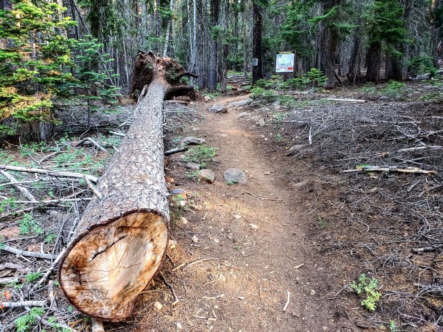
There were a bunch of downed trees early in the trail.
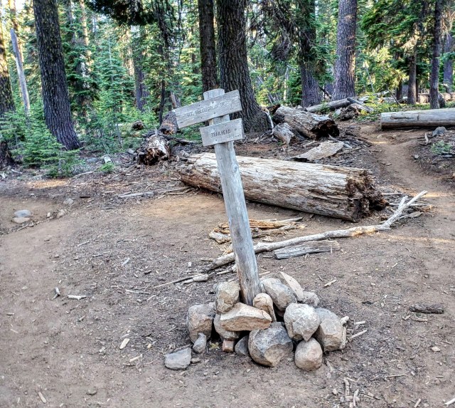
Just a few minutes in to the hike was a repeat of the “don’t get lost by taking a shortcut” warning.
Hunter Breckenridge – 2019
Seemed like good advice to me.
Hunter Breckenridge – 2019
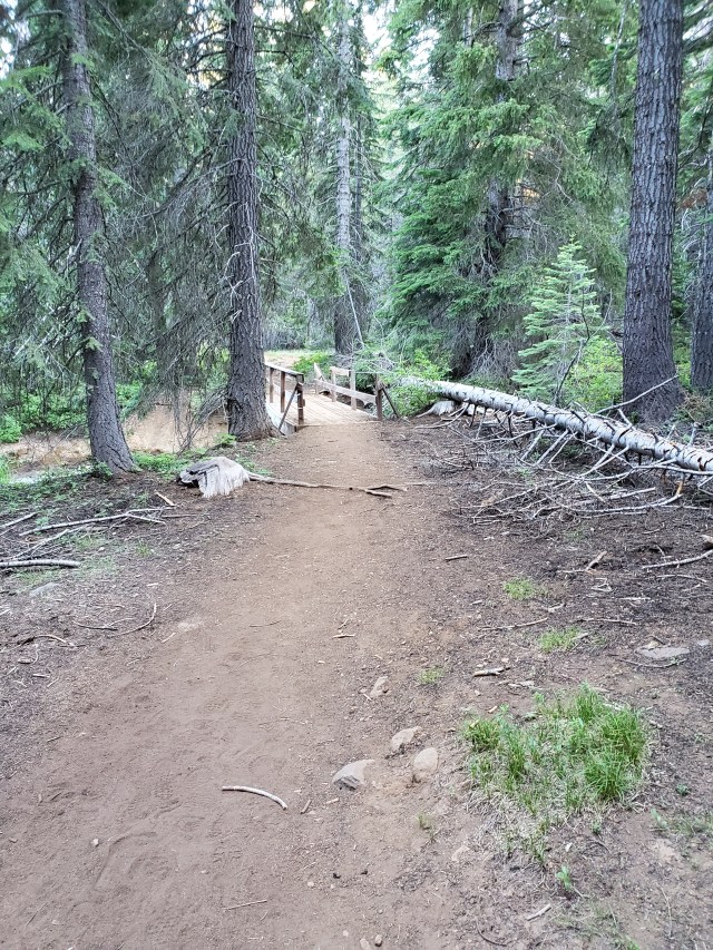
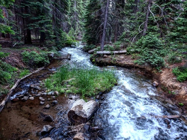
Just a bit further down the trail was a bridge spanning a surprisingly active river.
Hunter Breckenridge – 2019
Hunter Breckenridge – 2019
The first two and a half miles were mostly soft dirt and mulch with a fairly gentle incline.

Hunter Breckenridge – 2019
The first half of the trail is fast and easy. It’s important to remember that this could lead one into a false sense of what lies ahead.
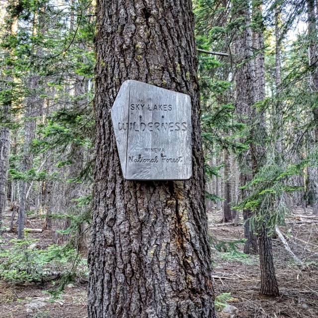
Like several big Cascade hikes, the trail intersects with the Pacific Crest Trail.
Hunter Breckenridge – 2019
Just over an hour into the hike, I had already made it nearly three miles, on a trail that averages just under five miles each way. But that progress was slowing as the trail grew steeper and rockier, and the elevation rose over 7,000 feet.
It was around this point that I begin seeing signs of encouragement.

Hunter Breckenridge – 2019
It was also around this point that the forest started thinning, and views around the mountain appeared in the sporadic gaps of the foliage.

Hunter Breckenridge – 2019
Hunter Breckenridge – 2019
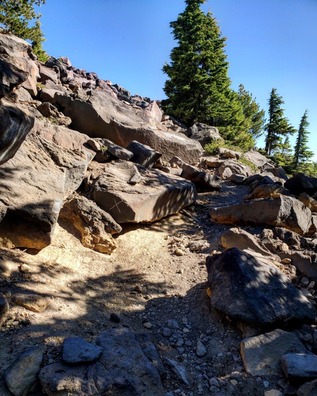
The trail itself was transforming from a dirt path laced with occasional rocks, to mostly gravel with a lot of rocks, to just rocks with a few patches of gravel here and there. This made it trickier to follow. I kept an eye on the map downloaded from the All Trails app, but I wanted to avoid relying on it too heavily. I’ve let GPS access rot my brain while driving already – best to not allow it to become a crutch on hikes. That said, it is good to have tools for navigation while hiking solo through an unknown (to me) area. I also have a compass, and kept a printed map in my pack. But modern trail mobile apps are an amazing resource.

Hunter Breckenridge – 2019
As the trail turned into a boulder scramble, the best navigation tool turned out to be some decent soul(s) marking paths along many of the rocks. They weren’t consistently marked, but the arrows and white dots littered the mountain enough to help maintain a basic route up toward the summit. The forest continued to thin out, but there wasn’t the abrupt treeline transition that I’ve seen on a few other peaks, such as South Sister. The change was more gradual. Or maybe it wasn’t that as much as the fact that I was really slowing down as I approached mile 4 (and around 8,000 feet), which caused me to see the treeline disappear more gradually than it actually was.
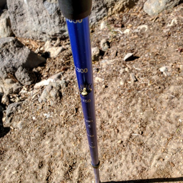
It was also around this point that I noticed there were a huge number of bumblebees flitting about. They were a welcome change of pace from the mosquitoes I encountered sporadically for the first hour of the hike. They also encouraged me to work on my Nic Cage impression – fortunately there weren’t many other hikers around to suffer through that.
And they really seemed to enjoy my hiking poles.
Hunter Breckenridge – 2019
Just past 8,000 feet, I also found the first patch of snow. The temperature was low 50’s at that point, but it felt much warmer. Another hiker I eventually ran into on the way back down noted he was going to lay down in that patch.

Hunter Breckenridge – 2019
Most of the trail markings were arrows and dots, but once in a while, X really did mark the spot.
Hunter Breckenridge – 2019
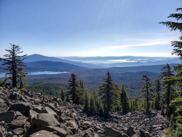
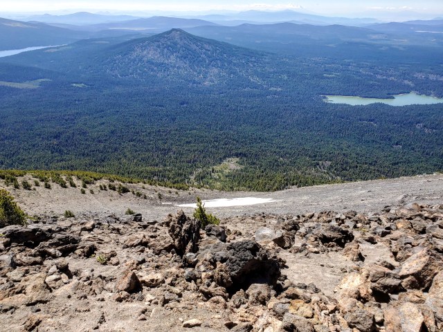
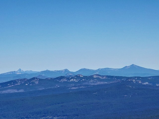
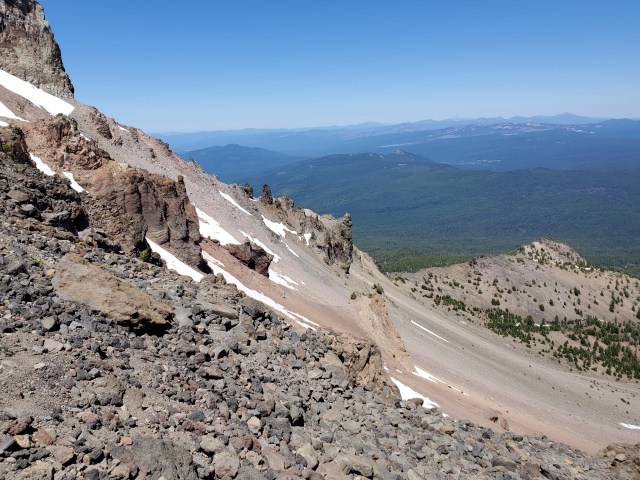
I was finally getting some really good long-range views at this point. Brown Mountain stands almost directly south.

Hunter Breckenridge – 2019
Glancing back up the trail, I still had a long way to go – even though the total remaining trail distance was just a mile or so.
Hunter Breckenridge – 2019
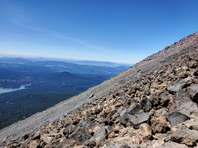
As I ascended, the views kept getting better and better. This was fortunate, since I had to stop and enjoy them frequently. I was finding myself becoming winded faster the higher I went.

Hunter Breckenridge – 2019

Hunter Breckenridge – 2019

Hunter Breckenridge – 2019
Hunter Breckenridge – 2019
Hunter Breckenridge – 2019
Risking a look back up, it still looked like I had FOREVER to go. The marked trail had taken me noticeably west of both the ridge and the marked path on my app. But I was still moving, and I could see other hikers above and below me following the same route.

Hunter Breckenridge – 2019
At this point, it was kind of academic. The primary direction I needed to go was UP. Having a trail was nice, but as long as the way was passable, it didn’t really matter much.

Hunter Breckenridge – 2019
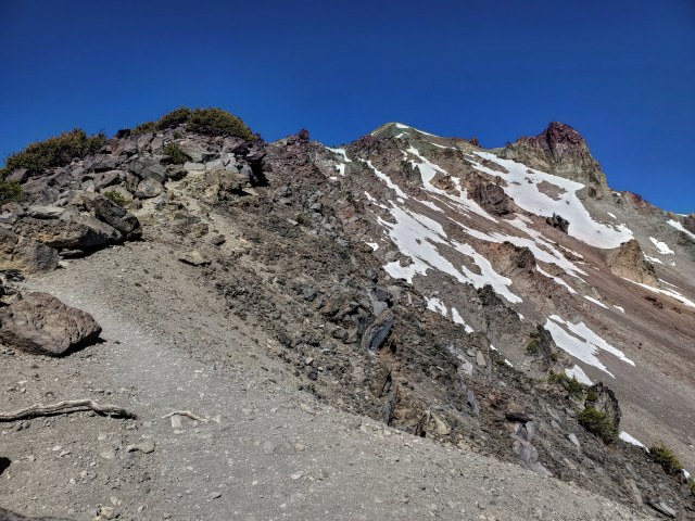
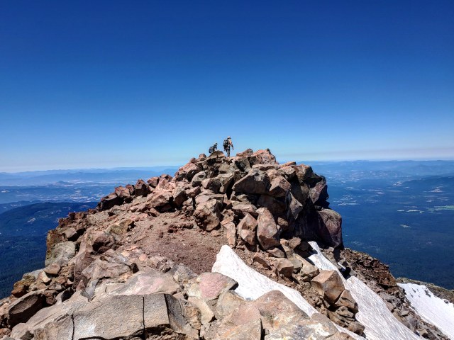
By the time I neared 500 feet of the summit, the path was pretty much just a constant boulder scramble. There were still markings here and there, but I was mostly just following the ridgeline (albeit slightly to the left), and faster climbers.
Speaking of those, I came across a few groups along the way. There was a father-son duo from Nevada. Dad was a geologist, and had been instructing his son to grab a small handful of rocks to take back home as samples. There was another family of a father and two sons – the father eventually had to stop a couple hundred feet from the summit. He yelled to his sons to keep going, though I did help him up over a six foot ledge so he could wait for them in some shade. There was also a solo hiker from Illinois who was wearing headphones, and blasting music loud enough for me to recognize AC/DC obliterating his eardrums. And yet, somehow he was able to carry on a conversation with no problem, despite the music.
While I usually hike solo because it affords me the opportunity to commune with nature human-free, the people I do encounter are almost invariably interesting, thoughtful, and kind-hearted. I’m always impressed with how decent hikers and climbers have been, when I come across them in the middle of nowhere.
After helping the father of two get settled, I paused as well, and took in the view to the south. Off on the horizon, Mount Shasta loomed, partially obscured by clouds.

Hunter Breckenridge – 2019
The geologist and son had stopped near the summit to take a break. I stopped and chatted with them for a few minutes. As we spoke, Mr. AC/DC stuck his head out from behind a rock above us. He was less than a hundred feet away. “Hey guys, the summit’s right here!” We had been resting just below the top.
It was just a few more steps, then at about 12:15, I stood on top of Mount McLoughlin.
Hunter Breckenridge – 2019
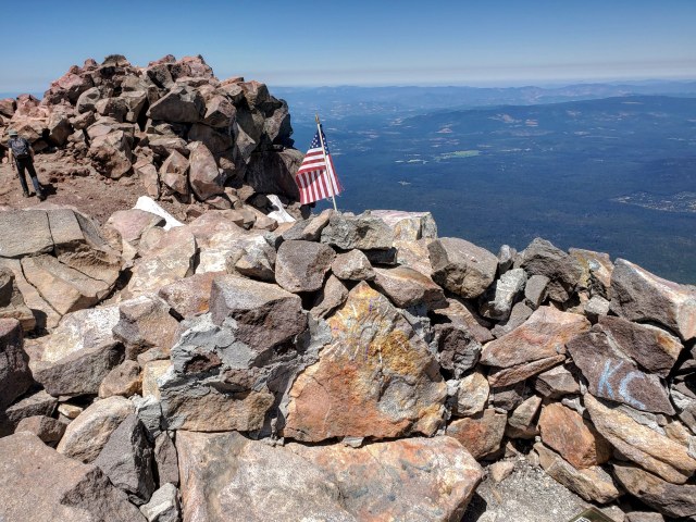
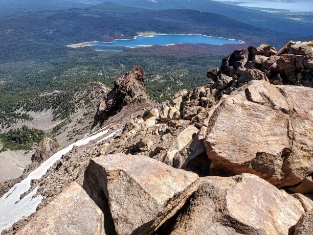
The overall summit complex consisted of two raised sections, with a tiny col in between. The two summit bulges were less than 100 feet apart. The western peak was just a bit higher. So after dumping my pack at the lower summit, I clambered over a short ledge, past an American flag, and joined the geologist and his son for some views from the true peak of the mountain.
Hunter Breckenridge – 2019
We traded cameras and took a few photos of each other.
Hunter Breckenridge – 2019
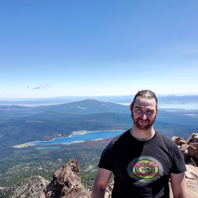
After they headed back to the lower summit, I remained behind long enough to set the timer on my phone and take my traditional thumbs-up photo. Well, it’s a tradition in that these photos amuse my sister, and I would be a terrible brother if I didn’t take a moment to make her laugh.

Hunter Breckenridge – 2019
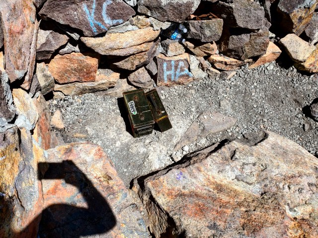
At the top of the lower peak, near the flag, there sat the remains of an old fire lookout station. A couple of old ammo cans sat nestled near a wall. One contained some water and a first aid kit. The other had several notebooks and a couple pens – a trail register.
Hunter Breckenridge – 2019
I also took a moment to plant my own flag on the summit.

Hunter Breckenridge – 2019
I settled back down under the lower summit to enjoy a sandwich and some conversation with my fellow hikers. The views were spectacular.
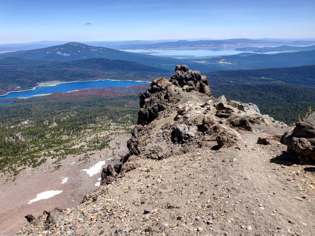
Looking off to the north, Mount Thielsen (left) and Mount Scott (right) sat invitingly.
Hunter Breckenridge – 2019
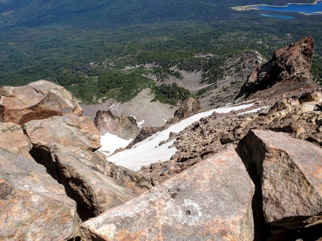
The trail back down appeared… daunting.
Hunter Breckenridge – 2019
Hunter Breckenridge – 2019
After a little more than half an hour eating lunch and talking, we could hear voices from below. There were at least three waves of hikers on their way up – with one group less than five minutes out. AC/DC appeared to be settling in for a nap, but I decided I was ready to get back on the trail. The geologist and son were starting to pack up as well.
I got myself together, grabbed my hat, bid the summit and Mr. Classic Rock adieu, and started clambering back down, high fiving the group of five college-age kids as they passed me.
Hunter Breckenridge – 2019
The first twenty minutes down consisted of the rock scramble I dealt with going up, but I noticed there was a path along the left side, near the edge of the ridge. It consisted mostly of loose scree, which I had briefly attempted, then rejected on the way up. Picking my way up boulders made more sense going toward the summit, but heading back down, I could boot ski along the ridge, with the boulders to my right, and a sharp drop off to the steep (and still partially snow-covered) scree slope on my left.
Hunter Breckenridge – 2019
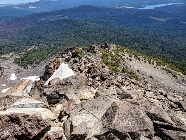
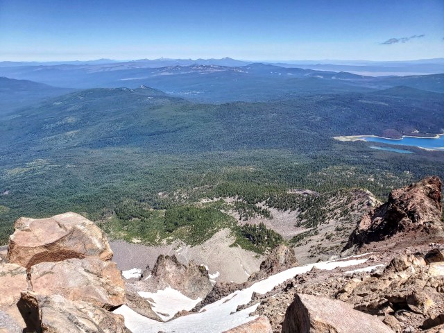
The trail stopped at several ledges, each of which provided great views.
Hunter Breckenridge – 2019
From there, it was just a slow slog, alternating between the scree slope, and occasional boulder piles that I couldn’t bypass.
Hunter Breckenridge – 2019
Eventually, I found my way back into the woods, and the path became clearer. I came across some interesting vegetation at around 7,500 feet.
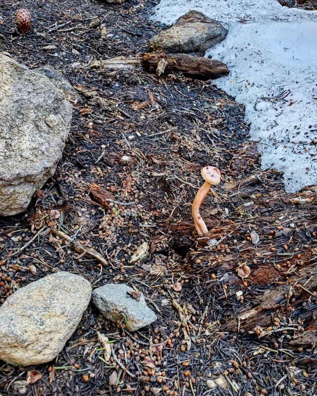
Hunter Breckenridge – 2019
Deeper into the woods, the mosquitoes started back up. This time, they were ferocious and constant. I found myself slapping and scratching my arms and neck pretty much nonstop for the final hour. Fortunately, the last three miles went just as quickly as the first three.
Just a bit before 4:30, I found myself back at the trailhead, shooing skeeters away from my car. I could now check McLoughlin off my list. But I’m pretty certain I’ll be back.
Meanwhile, I’ll be hiking Mount Bailey soon. There should be a report on that one within the next couple weeks. And hopefully, I can finish some of my political posts that have been rotting for the past few months.
Maybe.
Or maybe I’ll just stick to climbing. That’s a lot more fun.
